Loss Creek Cove History (PDF)
File information
Author: Jason Lehn
This PDF 1.5 document has been generated by Microsoft® Word 2010, and has been sent on pdf-archive.com on 04/11/2013 at 21:41, from IP address 184.174.x.x.
The current document download page has been viewed 998 times.
File size: 2.15 MB (12 pages).
Privacy: public file


File preview
1
Loss Creek Cove lies in the Cherokee National Forest just north of
the Hiwassee River, an area rich with history predating the
formation of the state of Tennessee. Along with public land owned
by the Polk County School Board, Loss Creek Cove is completely
surrounded by land controlled by the US Forest service as a part of
the Cherokee National Forest.
In prehistoric times, the region was inhabited by the Woodland
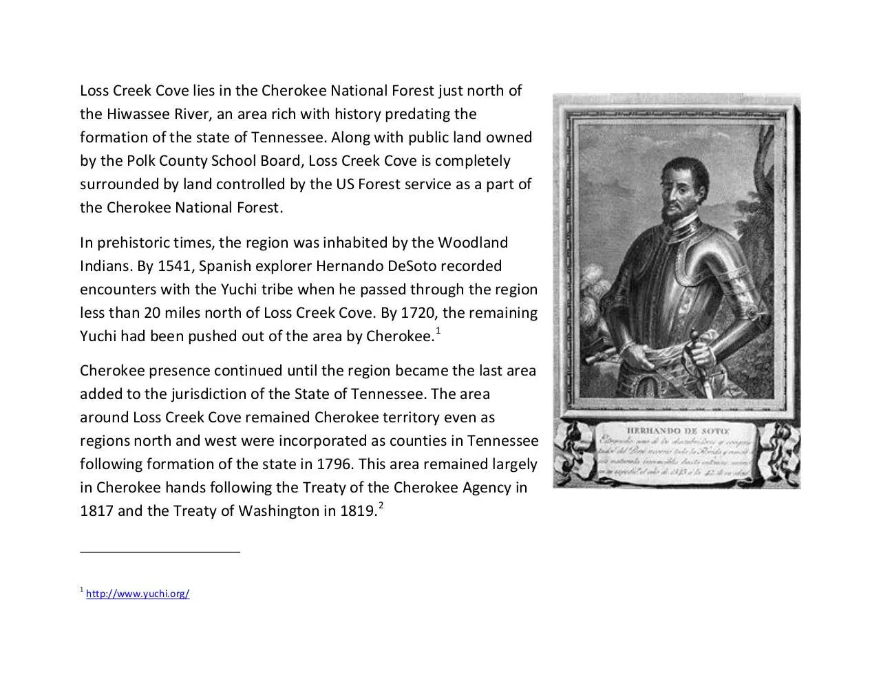
Indians. By 1541, Spanish explorer Hernando DeSoto recorded
encounters with the Yuchi tribe when he passed through the region
less than 20 miles north of Loss Creek Cove. By 1720, the remaining
Yuchi had been pushed out of the area by Cherokee.1
Cherokee presence continued until the region became the last area
added to the jurisdiction of the State of Tennessee. The area
around Loss Creek Cove remained Cherokee territory even as
regions north and west were incorporated as counties in Tennessee
following formation of the state in 1796. This area remained largely
in Cherokee hands following the Treaty of the Cherokee Agency in
1817 and the Treaty of Washington in 1819.2
1
http://www.yuchi.org/
Those treaties established ways to address differing
desires among Cherokees regarding emigration.
Some Cherokees, mostly in the northern townships,
favored emigration while most southern townships
opposed it, preferring instead assimilating into the
European culture of the white settlers, or
“acculturation”. Under the treaties, those who
desired to emigrate, mostly to the north, received
certain benefits for doing so. Those who desired to
stay, including most in the region of Loss Creek Cove,
would be given land grants and the possibility of
state citizenship.
In the decade that followed, the northern areas were surveyed, but the Cherokees in the south hindered
surveying until the 1830s. It was not until 1833 that the jurisdiction of the State of Tennessee was
officially extended to the southern border and included this region. The region remained unsurveyed until
after the Treaty of New Echota in 1836, the treaty which resulted in the Trail of Tears, the forced
evacuation of remaining Cherokee. Following that treaty, surveying began the newly established Ocoee
Survey District.3
2
3
http://en.wikipedia.org/wiki/Cherokee_treaties
http://www.tngenweb.org/tnland/survdist.htm
Initial surveying in the Ocoee District followed the Public
Land Survey System as established in the Congressional
Land Ordinance of 1785. This system described land, not
by metes and bounds, but by survey “townships”,
sections, and ranges designed to facilitate ease of
conveyance without needing a metes and bounds
description, which is much more difficult to survey. Each
survey township was 6 miles wide and 6 miles long. Within
each township were 36 sections, each 1 square mile, or
640 acres. Sections were numbered as shown in the grid at
right.
Most surveys under this system were laid parallel to
longitude and latitude, but in some sections of the
country, ranges were turned to run parallel generally with ridges and rivers. The townships in the Ocoee
District were laid at an angle roughly parallel to the Tennessee River and the mountain ranges in the area
as shown in the aerial on the next page
The Public Land Survey System was proposed originally by Thomas Jefferson to facilitate the disposition of
public lands. The system was adopted in 1785 following the American Revolution to make it easier to sell
large public lands to help pay off the debt incurred fighting the war.4 As noted earlier, because the system
was based on a grid, land could be sold by general reference to sections, quarters, and sub-quarters
within townships without knowing the metes and bounds description of a parcel. Jefferson’s interest in
public education no doubt influenced the practice under the system that the 16th Section of each
township was to be reserved and devoted to public education purposes.
After the Treaty of New Echota in 1836, Land in the Ocoee District was open to “all enterers” at set prices
to “discourage speculators and to
encourage honest settlement.” This
policy was in keeping with the purpose
of the Public Land Survey System to put
land in the hands of “yeoman farmers”
while providing revenue to reduce the
public debt. The starting price of $7.50
per acre, and the price decreased every
two months until it reached one cent per
acre.5
The legal description in the deed for Loss
Creek Cove property description in the
4
5
http://en.wikipedia.org/wiki/Public_Land_Survey_System
http://www.ajlambert.com/history/hst_lr.pdf
deed says that Loss Creek Cove lies in “Section 21 in the Fourth Range East of the Basis line and in the First
[Survey] Township of the Ocoee District.” Section 21, containing Loss Creek Cove as shown in the grids,
lies just south of the 16th Section, the one devoted to educational purposes.
But there was a problem with the system as applied to the township containing Loss Creek Cove. By the
time the Ocoee District was surveyed, some settlers were already residing in what, with the survey, would
become the education-designated 16th Section. Those citizens had purchased small parcels along Loss
Creek from the Cherokee, not knowing that their land would ever be subject to Public Land System
Survey. Those citizens were concerned about being forcibly removed without compensation, and they
petitioned the Tennessee General Assembly for
compensation for what they had paid to the Cherokee for
the land and for what they had invested in improving it.
Apparently, as an alternative to cash, those citizens
affected by the survey system sought contribution of 40
acres somewhere in the district when the price of unsold
land reached $1 per acre. 6
Among those citizens was John Hicks. “Hicks” was not an
uncommon name in Monroe and Polk Counties in the
middle of the 19th Century, and many were Cherokee.
6
http://www.tngenweb.org/bradley/PET1a.htm
Charles Renatus Hicks was an important Cherokee leader until his death in 1827. He became principal
chief of the Cherokee Nation and advocated, along with his protégé John Ross (shown at right) for
“acculturation” of the Cherokee with the European settlers.
Whether John Hicks had any direct family
relationship to the Cherokee, John Hicks
participating in the petition indicates that
the Hicks family had a connection to
property in the Loss Creek Cove area
predating the creation of the Ocoee
District following the Treaty of New
Echota. That connection may have led to
the Hicks family being the first recorded
owners of Loss Creek Cove in the 1870’s.
John Hicks remained in Polk County at least as late as the 1870 Census.7 And his descendants remained in
Polk County thereafter.8
Three generations of Hicks family owned the property which is Loss Creek Cove, and the family held it
when, in 1910, this region supplied more than 40% of the nation’s lumber. In 1911, the Weeks Act gave
the federal government the authority to buy up private forest land to create national forests to be
7
8
http://genforum.genealogy.com/hicks/messages/11670.html
http://genealogytoday.com/pub/polktn.htm?A=Cousin
preserved against unregulated logging. Public land in the region became part of one or another national
forest. In 1936, President Franklin D. Roosevelt combined the Tennessee sections of the Unaka, Cherokee,
and Pisgah National Forests, and the Cherokee National Forest took its present form: 640,000 acres
entirely within the borders of Tennessee, from Bristol to Chattanooga, divided into two sections by the
Great Smoky Mountains National Park.
All of this happened around the Hicks family’s
property, and around the School Board Property.
Though no school was ever built in Section 16,
the Polk County School Board has owned the land
since formation of Polk County in 1839. To this
day, Polk County School Board uses the land to
generate forestry revenue. As shown by the
topographic map, the land with white
background, owned by the Hicks family (outlined
in yellow) and Section 16 owned by the school
board, remained private and did not become a
part of the Cherokee National Forest, which is
shown with a green background.
With harvestable forest land in the area scarce as a result of the formation of the Cherokee National
forest, James Hicks sold what is now Loss Creek Cove to the West Lumber Company in 1948. West was
apparently a large lumber company in the southeast in the middle of the 20th Century, and held the
property for nearly four decades.
Modern accounts from locals indicate that while West
Lumber owned the land, “enterprising individuals” took
advantage of the seclusion and the terrain offered by
Loss Creek Cove to produce certain products for which
the region is well-known, exemplified in the photo at
right. In addition to seclusion, the property’s large
supply of sourwood trees, known to produce little if any
smoke, and the clear water of Loss Creek also would
have attracted such enterprises to Loss Creek Cove.
Accounts from locals indicate that Loss Creek Cove
indeed housed its share of moonshine stills during the
years that the property was owned by West Lumber
Company.
West owned the main 144 acres property until selling it in November 1984 to Oliver Smith, from Knoxville,
Tennessee. Smith acquired an additional 20 acres to the bringing the total to 164 acres. Smith cleared 19
acres of land along Loss Creek and created the orchard in the upper meadow planting nearly 450 trees
including Chinese chestnut, wild plum, cherry trees, and apple trees. Though not maintained for revenuegenerating production today, the trees still produce chestnuts, plums, cherries, and apples.
In 1992, Smith sold the property to the Madigan family, and they
began constructing roads and buildings, and clearing the lower
meadow. They formalized the easement from the Polk County
School Board for Loss Creek Cove’s entry road, which comes off of
Fingerboard Road just in Section 16, just north of the section line
which serves as the property’s northern boundary. The Madigans
built the picnic pavilion on the banks of Loss Creek, and they built
the small cabin and the barn in the orchard. Finally, they built the
2,700 SF log home at the top of the eastern peak on the property.
The home was featured in 2002 in a Log Home Magazine article
entitled “Lovely at the Top.”9 The Madigans also cut several roads
on the property, including one to Happy Top and the Saddle Road to the lower meadow to provide access
to that within the property’s boundaries.
In 2009, the Brant family purchased the property, using it as a family retreat. The Brants installed a
propane generator and improved the infrastructure of the property, including geotextiles under the gravel
roads to make them more durable and less susceptible to erosion. They also made a number of
improvements to the home, including a new deck along the southern end of the home, providing the
ultimate sunset observation spot in Loss Creek Cove with views across horizons beginning in Alabama and
extending through Georgia into North Carolina. The Brants have maintained the property’s pastoral and
9
http://books.google.com/books?id=cA8AAAAAMBAJ&lpg=PP1&authuser=1&pg=PP1#v=twopage&q&f=false
wooded lands, and enjoyed skeet shooting, hunting, hiking, and other recreational activities on the
property.
Despite this long history, the beautiful and historic land has had only 5 owners. The next chapter will be
written by the 6th owner of Loss Creek Cove.
Herman Walldorf Commercial, Inc.
109 East Eighth Street | Chattanooga, Tennessee 37402
423.756.2400 (O) | 423.838.3600 © | bpitts@walldorf.com
Download Loss Creek Cove History
Loss Creek Cove History.pdf (PDF, 2.15 MB)
Download PDF
Share this file on social networks
Link to this page
Permanent link
Use the permanent link to the download page to share your document on Facebook, Twitter, LinkedIn, or directly with a contact by e-Mail, Messenger, Whatsapp, Line..
Short link
Use the short link to share your document on Twitter or by text message (SMS)
HTML Code
Copy the following HTML code to share your document on a Website or Blog
QR Code to this page

This file has been shared publicly by a user of PDF Archive.
Document ID: 0000133508.