calcul itinéraire (PDF)
File information
Title: calcul itinéraire
Author: Alexis
This PDF 1.4 document has been generated by PDFCreator Version 1.7.1 / GPL Ghostscript 9.07, and has been sent on pdf-archive.com on 28/09/2014 at 20:22, from IP address 77.150.x.x.
The current document download page has been viewed 500 times.
File size: 376.15 KB (1 page).
Privacy: public file
File preview
Calcul d'itinéraires (Jogging, Course à pied, Vélo, Cyclisme, Roller, R...
1 sur 1
http://www.calculitineraires.fr/print.php
www.calculitineraires.fr
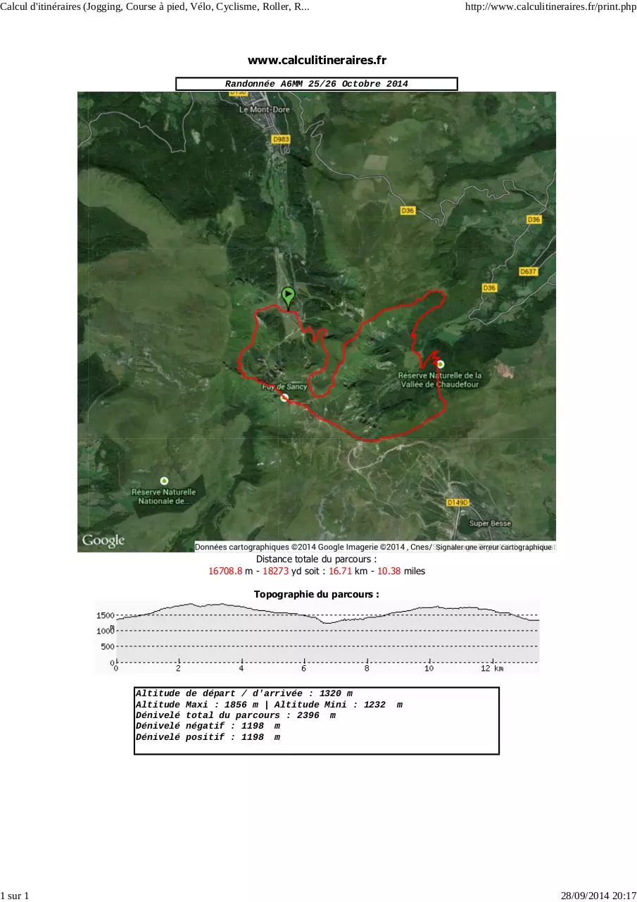
Randonnée A6MM 25/26 Octobre 2014
Distance totale du parcours :
16708.8 m - 18273 yd soit : 16.71 km - 10.38 miles
Topographie du parcours :
Altitude
Altitude
Dénivelé
Dénivelé
Dénivelé
de départ / d'arrivée : 1320 m
Maxi : 1856 m | Altitude Mini : 1232
total du parcours : 2396 m
négatif : 1198 m
positif : 1198 m
m
28/09/2014 20:17
Download calcul itinéraire
calcul itinéraire.pdf (PDF, 376.15 KB)
Download PDF
Share this file on social networks
Link to this page
Permanent link
Use the permanent link to the download page to share your document on Facebook, Twitter, LinkedIn, or directly with a contact by e-Mail, Messenger, Whatsapp, Line..
Short link
Use the short link to share your document on Twitter or by text message (SMS)
HTML Code
Copy the following HTML code to share your document on a Website or Blog
QR Code to this page

This file has been shared publicly by a user of PDF Archive.
Document ID: 0000186330.