FINAL NNSP HIA 1031.compressed (PDF)
File information
Title: Microsoft Word - NNSP_HIA_FINAL_1031.docx
Author: K.O. Campbell
This PDF 1.6 document has been generated by Word / 3-Heights(TM) PDF Producer 4.4.36.0 (http://www.pdf-tools.com), and has been sent on pdf-archive.com on 06/01/2015 at 16:43, from IP address 108.29.x.x.
The current document download page has been viewed 726 times.
File size: 4.1 MB (107 pages).
Privacy: public file


File preview
Northeast Neighborhood Sustainability Plan –
Health Impact Assessment
Final Report and Recommendations
September 2014
TABLE OF CONTENTS
1.
Forward………………………………………………………………………………………..………………………………..5
2.
Introduction…………………………………………………………………………………..…………………………..….6
3.
Health Impact Assessment……..…………………………………..…………………..…………………………....8
4.
Screening: Project Background………………………………………………………..………….…………………9
A.
Lead Organizations……………………………………………………………..………………………………9
1.
Community Solutions……………….……………………..……………………..………………9
2.
Michael Singer Studio………………………………………………………….………………..10
3.
Georgia Health Policy Center………………………………..………………………………11
B.
Northeast Neighborhood Sustainability Plan……………………..……………………………..11
C.
Integrating the NNSP & HIA Processes…………………………………………………….………..12
5.
Baseline Neighborhood Conditions and Community Health Profile………………………………13
A.
Baseline Neighborhood Conditions…………………………………………………………………..13
B.
Baseline Community Health Profile………………………….……………………………………….16
C.
Defining Health……………………..………………………………………………………………………….17
6.
Changing the Narrative: From Loss to Opportunity………………………………….………….……….22
A.
Scoping: Development of NNSP-‐HIA Opportunities………………………………………….23
B.
Stakeholder Engagement in the NNSP-‐HIA Process……………………………….………….24
7.
Assessment & Recommendations………………………………………………………………………………..29
A.
Assessment Overview……………..……………………………….…………………………………….…29
B.
Recommendations: Final NNSP-‐HIA Opportunities…………………………….………….….31
1.
Opportunity 1: Safe Intersections………………………………….………………………31
2
2.
Opportunity 2: Productive Keney Park…………………………………….….…………42
1.
2.
3.
4.
8.
9.
10.
11.
2a: Pedestrian Access to Keney Park……………………………...………….44
2b: Alternative Management………………………………….………………..45
2c: Composting………………………………………………….….………………….47
2d: Selective Harvesting……………………………………..…………………....52
3.
Opportunity 3: Vacant Lot Reactivation…………………………………………….….60
4.
Opportunity 4: Street Trees and Electric Service…………………………..……….68
5.
Other Opportunities for Consideration………………………………………….………74
Conclusions…..…………………………………………..………………………………………………………….……..76
Monitoring and Evaluation…………………………………………………………………………………….…….78
A.
Process Evaluation………………………..…………………………………………………………….……78
B.
Impact Evaluation…………………………………………………………………………………………….82
C.
Monitoring…………………………………………………………………..…………………………………..83
Acknowledgements………………………………………………………………………………………………………84
Appendices
A.
Stakeholder List………………………………………………………………………………..………………85
B.
Resources…………………………………………………………………………………………..…………….86
C.
D.
Advisory Committee List ……………………………………………………….…..…………………….88
Preliminary Opportunities………………………………………………………….…………………….89
E.
Community Engagement Report……………………………………………………………………….92
F.
Survey and Survey Results……………………………………………………………….……………….95
G.
City of Hartford Map………………………………………………………………………….……………101
H.
City of Hartford Vacant Land by Zone Map…..……………………………….…….………….102
3
I.
City of Hartford Zoning Districts Map………………………………………………………………103
J.
Placemaking Assets and Activities Database……………………………………………………104
4
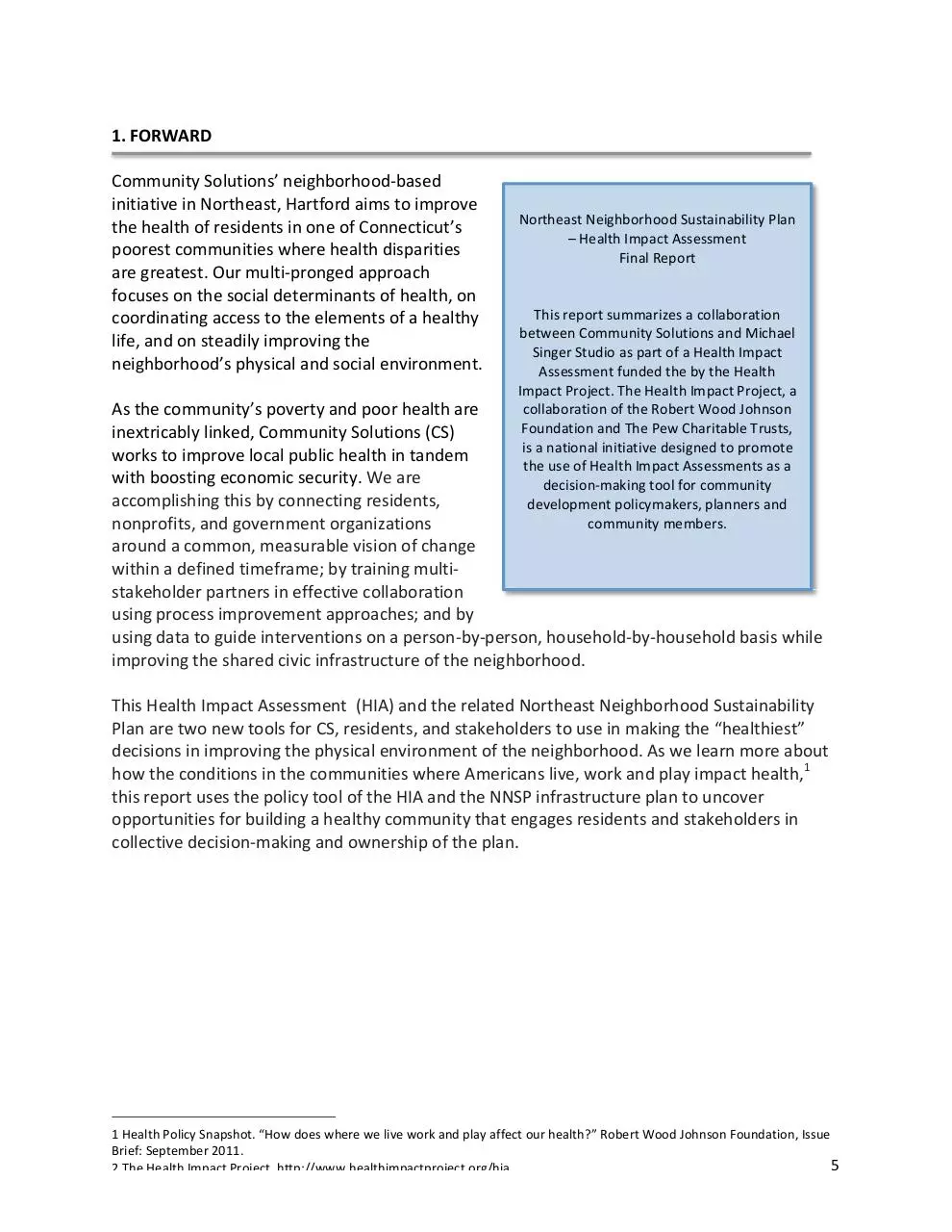
1. FORWARD
Community Solutions’ neighborhood-‐based
initiative in Northeast, Hartford aims to improve
Northeast Neighborhood Sustainability Plan
the health of residents in one of Connecticut’s
– Health Impact Assessment
poorest communities where health disparities
Final Report
are greatest. Our multi-‐pronged approach
focuses on the social determinants of health, on
This
r
eport
s
ummarizes
a collaboration
coordinating access to the elements of a healthy
between Community Solutions and Michael
life, and on steadily improving the
Singer Studio as part of a Health Impact
neighborhood’s physical and social environment.
Assessment funded the by the Health
Impact Project. The Health Impact Project, a
collaboration of the Robert Wood Johnson
As the community’s poverty and poor health are
Foundation
and The Pew Charitable Trusts,
inextricably linked, Community Solutions (CS)
is a national initiative designed to promote
works to improve local public health in tandem
the use of Health Impact Assessments as a
with boosting economic security. We are
decision-‐making tool for community
accomplishing this by connecting residents,
development policymakers, planners and
community members.
nonprofits, and government organizations
around a common, measurable vision of change
within a defined timeframe; by training multi-‐
stakeholder partners in effective collaboration
using process improvement approaches; and by
using data to guide interventions on a person-‐by-‐person, household-‐by-‐household basis while
improving the shared civic infrastructure of the neighborhood.
This Health Impact Assessment (HIA) and the related Northeast Neighborhood Sustainability
Plan are two new tools for CS, residents, and stakeholders to use in making the “healthiest”
decisions in improving the physical environment of the neighborhood. As we learn more about
how the conditions in the communities where Americans live, work and play impact health,1
this report uses the policy tool of the HIA and the NNSP infrastructure plan to uncover
opportunities for building a healthy community that engages residents and stakeholders in
collective decision-‐making and ownership of the plan.
1 Health Policy Snapshot. “How does where we live work and play affect our health?” Robert Wood Johnson Foundation, Issue
Brief: September 2011.
5
2 The Health Impact Project. http://www.healthimpactproject.org/hia
2. INTRODUCTION
Community Solutions, in partnership with Michael Singer Studio and with the support of
Georgia Health Policy Center, led the development of Hartford’s Northeast Neighborhood
Sustainability Plan informed by a Health Impact Assessment (NNSP-‐HIA). The project was
supported by a grant from the Health Impact Project, a collaboration of the Robert Wood
Johnson Foundation and The Pew Charitable Trusts. Health Impact Assessments (HIAs) identify
the health consequences and benefits of new public policies, plans, projects, and programs
using a data-‐driven approach that can be adapted to specific contexts. This enables the
development of practice strategies that will enhance the health benefits of proposed policies
and interventions and will minimize adverse effects. This NNSP-‐HIA is one of three national
demonstration projects sponsored by the Health Impact Project highlighting the important role
that HIAs can play in community development.
As a part of our larger neighborhood improvement effort (described more in following sections),
this plan outlines the best opportunities for increasing the infrastructural and environmental
sustainability of the Northeast neighborhood, while positively impacting the health, safety and
economic opportunities of residents. Northeast is a neighborhood which suffers from high
crime, unemployment, and poverty rates and poor health outcomes for a large portion of the
population. Community Solutions, supported by a broad alliance of partners and residents, is
working to improve, simultaneously, the physical condition of the Northeast neighborhood as
well as the health and economic security of its residents.
Conditions in the places where we live, work and play have a tremendous impact on individual
health.2 Quality of life in communities is dependent on the ability to walk, run or bike safely; to
have clean air, healthy food and access to affordable housing; and to be safe from violent crime,
vehicle accidents, fires and other causes of injury. These health and socioeconomic issues all
play a role in the social determinants of health at the local level. The Centers for Disease
Control and Prevention outlines 12 core dimensions of the social environment that impact
health: economy, employment, education, housing, transport and public health, as well as
political, environmental, medical, governmental, psychosocial and behavioral factors, with each
dimension having several components. Within both policy and practice, there is an increasing
recognition at all levels of government, at the community level, and within the formal
healthcare sector of the need to understand, and have a role in addressing, these social
determinants of health.3
CS facilitated the development of this community-‐driven sustainability plan which includes
detailed strategies for specific sustainable physical infrastructure improvements in the
neighborhood utilizing better health outcomes for residents as a key driver. Sustainability of
infrastructure and environment, in this case, refers to using or building physical infrastructure
2 The Health Impact Project. http://www.healthimpactproject.org/hia
3 Hillemeier, M, Lynch J, Harper S, Capser M. (2004). Data Set Director of Social Determinants of Health at the Local Level.
Atlanta: U.S. Department of Health and Human Services, Centers for Disease Control and Prevention.
6
in a way that contributes to the overall quality and sustainability of natural resources, such as
energy, tree canopies, water and air.
The purpose of the NNSP-‐HIA is to provide background and precedents, aspirational plans and
concepts, and neighborhood-‐specific strategies to guide the near term implementation of
health-‐supporting developments in the Northeast neighborhood. The relationship between the
different opportunities presented by this NNSP-‐HIA highlights the various components of each
opportunity and ways to maximize the efficacy of each action. Additionally, because the HIA
process—described below—emphasizes community engagement, the decision to combine the
NNSP with the HIA has enhanced the community input and ownership of the process and
decisions on priorities will guide the eventual implementation of the improvements. This
framework generated consensus and ideas for jointly advancing health and economic indicators.
It will also be of service in advancing economic development, environmental and civic
engagement objectives, and population health goals.
The goals of the integrated NNSP-‐HIA project are:
1.
To develop a neighborhood sustainability plan that includes key opportunities for
physical and environmental change to improve the Northeast neighborhood and the
health and well-‐being of its residents;
2.
To create a core document (the HIA) as a source recommending key positive and
sustainable physical infrastructure changes to ensure that health remains a critical
consideration in the development of neighborhood plans;
3.
To bring together a diverse group of stakeholders through the NNSP-‐HIA processes to
create a shared agenda for community development that will have a significant positive
impact on the health and well-‐being of residents, increase the likelihood of success and
ensure accountability;
4.
To use community-‐identified priorities -‐ safety, employment and youth engagement -‐ as
a framework for recommendations; and
5.
To highlight existing assets and opportunities within the Northeast neighborhood as key
areas for investment.
The NNSP-‐HIA was developed through direct interactions with community residents and
stakeholders as an action-‐focused vision for the future of the Northeast neighborhood. It
provides background information on existing neighborhood conditions and offers precedents
for recommendations using the HIA and stakeholder input to prioritize steps and strategies and
to guide implementation.
7
3. Health Impact Assessment
The International Association of Impact Assessment (IAIA)
defines the Health Impact Assessment (HIA) as “a combination
of procedures, methods and tools that systematically judges
the potential, and sometimes unintended, effects of a policy,
plan, program or project on the health of a population and the
distribution of those effects within the population.”4
All HIAs follow a basic process that can be used in a broad
range of applications. There are six basic steps that are
consistent:5
1.
Screening: This step involves determining whether an
HIA is feasible, timely, and would add value to the
decision-‐making process.
2.
Scoping: This step creates a plan and timeline for
conducting an HIA that defines priority issues, research
questions and methods, and participant roles.
3.
Assessment: This step involves a two-‐stage process of:
1.
Creating a profile of the existing conditions for
a geographic area and/or population in order
to understand baseline conditions and to be
able to predict change; and
2.
Evaluating the potential health impacts,
including the magnitude and direction of
impacts using quantitative and qualitative
research methods and data.
4.
Recommendations: Recommendations are developed
to improve the project, plan, or policy and/or to
mitigate any negative health impacts.
5.
Reporting: This step involves creating written or visual
presentation of the HIA results and communicating the
results within the decision-‐making process.
6.
Monitoring: This step tracks the impacts of the HIA on
the decision-‐making process and the decision, the implementation of the decision, and
the impacts of the decision on health determinants.
4 Quigley R, L de Broeder, P Furu, A. Bond, B. Cave, R. Bos. (2006). Health Impact Assessment International Best Practice
Principles. Special Publication Series No. 5. Fargo, South Dakota, USA: International Association for Impact Assessment.
5 Health Impact Assessment Process. The Health Impact Project -‐
http://www.healthimpactproject.org/hia/process
8
4. SCREENING: NNSP-‐HIA PROJECT BACKGROUND
4A. Lead Organizations:
Community Solutions -‐ Community Solutions (CS) helps communities solve the complex
problems that affect their most vulnerable, hardest hit members. We draw on successful
problem-‐solving tools and strategies from diverse sectors like public health, manufacturing and
design. By adapting these strategies to civic and human services issues, we support the natural
wisdom and capacity of community members to develop solutions to their own most urgent
challenges.
We began our efforts by pioneering innovative solutions to homelessness. Today, we are at
work on a range of social problems that contribute to homelessness -‐ from concentrated
poverty to urban public health. We test, scale, and share new approaches to these issues for
the benefit of organizations and communities seeking smart, humane, and lasting solutions.
Our collaborative process results in more effective local services, more connected and resilient
communities, reduced taxpayer costs, and better lives for struggling people.
Whether at the neighborhood-‐ or system-‐level, we:
1.
Organize communities around a goal: a big, measurable, time-‐bound collective
challenge that unites them;
2.
Support collaborative problem solving by making it easier for groups from multiple
organizations to work together and, because we work nationally, cross-‐pollinate the
best ideas from around the country;
3.
‘Kickstart’ the process: we give groups some simple techniques that help them get
better at solving design and implementation problems quickly; and
4.
Facilitate continuous improvement by providing data on performance and coaching to
improve results.
Community Solutions began its comprehensive neighborhood improvement effort in the
Northeast neighborhood in 2012, selecting the neighborhood because of its extreme neglect
and health and income disparities. We organized a neighborhood collective of residents,
nonprofits and community organizations and governmental agencies to work jointly to improve
the health and prosperity of the neighborhood. In reviewing the administrative data on
Northeast and in discussion with community members and many other stake-‐holders, health
and the social determinants of health quickly emerged as the focus for collaboration in building
new approaches to neighborhood-‐level change.
Recognizing that the formal healthcare system has very limited capacity to address the social
determinants of health, and that no individual organization or program can change the course
of a low-‐income and under-‐resourced neighborhood like Northeast, CS functions as a
“backbone” structure for the neighborhood to connect over 40 healthcare, nonprofit and
government organizations. As a collective we focus on three complementary efforts to advance
the safety, health and prosperity of Northeast (which includes the Sustainability Plan described
in this report):
9
I. Northeast Neighborhood Sustainability Plan
To transform the deteriorated physical environment of Northeast into one that is stable,
productive and sustainable. Based on exploratory work done by the Conway School of
Landscape Design, noted for their work in sustainable landscape design, we engaged
Michael Singer Studios (MSS), master planner, to create a green neighborhood plan for
Northeast. MSS’ work has been informed by and is reflective of an iterative process of
community conversations, research, and the application of the HIA framework.
II. Swift Factory Redevelopment
To create jobs and help to revive the community's economic sustainability. CS is
redeveloping the 2.6-‐acre historic Swift Factory complex at 10-‐60 Love Lane at the
center of the Northeast neighborhood. Consisting of a historic 65,000 square foot
former gold leaf manufacturing factory, two historic residences and vacant land, the
Swift Factory will become the site of new, middle skill jobs available to Northeast
residents. The redevelopment of the factory overlaps with the NNSP-‐HIA as the goals of
the projects are the same: creating sustainable improvements in the neighborhood that
will impact the health, safety and economic activity of Northeast and the residents who
live there. The Swift Factory campus is an asset to the neighborhood and its adaptive
reuse will be integrated within the NNSP-‐HIA as redevelopment occurs over the next
two years.
III. Community Care Management
To offer high-‐touch, low-‐cost care coordination services to community members
struggling with multiple health, behavioral health, trauma, and/or substance abuse
needs, improving the health and social sustainability of the community. To this effect,
Community Solutions introduced a community-‐based care coordination (CBCC) program
in the Northeast neighborhood during the summer of 2012. This work has been
accomplished through a collaboration with Saint Francis and Hartford Hospitals, health
clinics, and the City of Hartford Department of Health and Human Services. CS will
expand the initiative in partnership with these same organizations, the State of
Connecticut and, very likely, the Medicaid Managed Care entity created by the State.
The next step/scale up will involve training a cadre of Northeast residents to serve as
Community Health Workers. By assisting individuals in better managing their health
conditions in their homes, we will demonstrate how more effective services can be
provided at a lower cost, while also creating good jobs for local residents.
Michael Singer Studio – Michael Singer Studio (MSS) is a multifaceted art, design, and planning
studio focused on understanding and expressing each project’s environmental systems and
interactions as well as exploring its social and educational potential. MSS projects are noted for
specificity to the site, aesthetic beauty, functionality, and artful details in design and fabrication.
The studio offers in-‐house architectural and landscape architectural design, planning,
interpretive design, fabrication, and construction, and is experienced in working with teams
that include a variety of other professionals from engineers to botanists and policy makers.
MSS has led a number of planning projects, some stretching over decades, to help transform
10
places, regenerate environments and revitalize communities. For these complex projects the
Studio teams with professionals and academics from a wide range of disciplines to develop
innovative approaches to planning and re-‐imagining the potential of place. MSS is a leader in
reimagining the role and interface of the critical infrastructure that sustains our everyday lives.
The Studio’s work has opened new possibilities for water, energy and waste infrastructure to be
present, transparent, and environmentally and socially transformational within the
communities they serve. More information about MSS can be found at:
www.michaelsinger.com.
As a partner in the NNSP-‐HIA process, MSS took the lead in researching existing regulatory,
governance and service issues that reinforce the neighborhood’s distress, as well as emerging
opportunities to reshape the community’s physical environment. This included City and State
initiatives now underway that can quickly advance the NNSP-‐HIA recommendations, such as a
review of the City’s zoning code and regional transit system; a study on the future of Hartford’s
parks, the Mayor’s plan to support more livable and sustainable neighborhoods; a new storm
water separation initiative by the Regional Water Board; and a focus on new waste
management and energy investments by the State.
Georgia Health Policy Center – The Georgia Health Policy Center (GHPC) is housed within the
Andrew Young School of Policy Studies at Georgia State University. It has more than 100 diverse
public and private clients on local, state, and national levels and has worked in more than 800
communities across the country. With more than a decade of combined experience in Health
Impact Assessment, GHPC provided technical assistance to Community Solutions throughout
the development of the NNSP-‐HIA. More information about GHPC can be found at
http://ghpc.gsu.edu.
4B. Northeast Neighborhood Sustainability Plan
In 2012, CS engaged MSS to help develop a community-‐driven sustainability plan for the
Northeast neighborhood. This plan built on the work of a student project conducted by the
Conway School of Landscape Design that examined potential changes to the physical
environment that would promote neighborhood vibrancy and safety, “A Vision For a Vibrant
Northeast, Hartford.”6 The Northeast Neighborhood Sustainability Plan (NNSP) includes detailed
strategies for increasing the infrastructural and environmental sustainability of the Northeast
neighborhood while also boosting population health and addressing other social determinants
of health.
The purpose of the NNSP is to provide background and precedents, outline plans and concepts,
as well as strategies for near-‐term implementation of priority initiatives. To that aim, the NNSP
emphasizes the relationships between the various components of neighborhood health and
how their combined value is greater than their sum. The NNSP used the HIA as a decision guide
for determining priorities and selecting interventions. The plan is a written and illustrated
report including strategies, diagrams, and plans for increasing the sustainability of Northeast
and is meant as an invitation to stakeholders to implement part, or all, of the plan.
6 Cullinan, S. and Jackson, R. (2012). “A Vision For a Vibrant Northeast Hartford.” The Conway School of Landscape Design.
11
The NNSP was developed through an iterative process with community residents, community
organizations and institutions as an action-‐focused infrastructure vision for the future of
Northeast. It is our intention that this be a living and breathing document that will continue to
change and evolve in response to needs and opportunities. CS, acting as a backbone
organization to help drive collective impact,7 will facilitate the implementation of the plan
recommendations to ensure forward movement toward a healthier and more vibrant
community.
4C. Integrating HIA and NNSP Processes
Through the screening process, CS and MSS, with support from the Health Impact Project,
determined that the HIA would be an invaluable tool in the development of the NNSP and
integrated the two processes. Developed by a team of residents, organizational and
government stakeholders that were supported by CS and MSS and advised by the Georgia
Health Policy Center and the Health Impact Project, this HIA was interwoven into the
development of the NNSP. At every step we aligned the goals of the NNSP and the process of
the HIA to include emerging findings and reflect resident and stakeholder input.
The NNSP-‐HIA addresses the operations of the entire neighborhood, including public
institutions and services, existing land uses and regulation, utility infrastructure, housing
conditions, open space, transportation and links to essential services and opportunities in the
rest of the City and region. The HIA framework positioned the NNSP to use evidence-‐based
interventions to support improved health and quality of life in Northeast. The HIA was critical in
providing evidence of health effects and supporting data to narrow and ultimately choose
neighborhood infrastructure interventions, such as showing links between reduced
unemployment and health.
7 Kania, J. and Kramer M. “Collective Impact.” Stanford Social Innovation Review: Winter 2011.
12
5. BASELINE NEIGHBORHOOD CONDITIONS & COMMUNITY HEALTH PROFILE
5A. Baseline Neighborhood
Conditions
The Northeast neighborhood
of Hartford is defined as the
area in northeast Hartford
bound by the city limits to the
north, Amtrak train tracks to
the east, F.D. Oats Avenue to
the south, and Keney Park to
the west. The neighborhood
has 10,711 residents, within a
city of 124,775,8 of which the
majority is African-‐American
(79%), followed by Latino
(19%). This project targets
health disparities between the
largely Black and Latino
population of the Northeast
Geographic A rea of NNSP-‐HIA Scope:
neighborhood, and the
Northeast Neighborhood of Hartford
markedly higher health
outcomes in Connecticut’s non-‐minority neighborhoods.
With a median household income of $26,180, a 21% unemployment rate, and 34.4% of
households living below the poverty level, Northeast is also the poorest neighborhood in one of
America’s poorest cities. Hartford has lost a third of its manufacturing jobs in the last 30 years
and 16% of its residents are currently unemployed,9 as compared to the state unemployment
rate of 7%10 and a national rate of 6.3%.11 Thirty-‐four percent of the heads of Northeast
households are female with children under 18 and a median income of $16,630;12over 95% of
Northeast families with children in school live in poverty (defined as eligible for free and
reduced lunch at school). As a comparison, median household income for the state of
Connecticut is one of the highest in the country at $69,519. In Northeast, only 55% of residents
between 16 and 65 years participate in the labor force and, in 2000, only 66% of the population
had a high school diploma and just 4.5% had college degrees.13
8
"2010 Census." 2010 Census. N.p., n.d. Web. 13 Oct. 2013.
9 American Community Survey. (2005-‐2009).
10 "Labor Market Information -‐ State of Connecticut Unemployment Rate."Labor Market Information -‐ State of Connecticut
Unemployment Rate. N.p., n.d. Web. 13 Oct. 2013
11 "Databases, Tables & Calculators by Subject." Bureau of Labor Statistics Data. N.p., n.d. Web. 13 Oct. 2013.
12
American Community Survey. (2005-‐2009)
13
American Community Survey. (2005-‐2009)
13
Baseline data from the Hartford Police Department shows that Northeast has the highest crime
rate in the city.14 The Northeast neighborhood contains 8.6% of the city’s total population, yet
it accounts for 22.7% of violent crimes citywide.
Other defining characteristics of the neighborhood are neglected housing stock, inadequate
infrastructure, low owner occupancy (17%),15 a significant number of vacant buildings, limited
capacity within social service agencies, limited resources for the homeless and the precariously
housed, and no full service grocery stores. Additionally, access to basic services is a significant
issue for Northeast neighborhood residents, as 43% of households do not own a car and public
transportation options in the neighborhood are limited. Keney Park, an expansive public park
adjacent to the neighborhood, is perceived as unsafe and is generally not well maintained,
discouraging most residents from using it.
14"HartfordInfo.org." HartfordInfo.org. N.p., n.d. Web. 13 Oct. 2013
15
Census. (2010);ACS. (2006-‐2010)
14
Table 1 below lists some of the key demographics of Northeast compared with the City of
Hartford, Hartford County and the State of Connecticut, and illustrates the disparities between
the NNSP-‐HIA’s neighborhood of focus and the rest of the city, county and state.
Northeast City of Hartford Hartford County
Connecticut
Subject
Population
Race
% Black
% White
% Latino
Age Distribution
Under 19
20-‐65
65+
Income
% Below Poverty Level
% Children in poverty
% With Food Stamp/SNAP benefits in last year
% Children eligible for free lunch
% Single-‐parent households
Female-‐headed household
Unemployment
Out of the Labor Force
Educational Attainment
High School Graduation Rate
Bachelor's degree or higher (%)
Students performing at grade level
Math
Reading
Housing
Total Number of Units
Owner-‐occupancy
Public Housing as a percentage of total rental
units
Vacancy Rate
Crime
Incidents of Violent Crime (Total #)
Local violent crime as a % of total violent
crime
10711
80%
1%
19%
34%
57%
9%
$26,180
124775
38%
29%
43%
34%
57%
10%
$28,931
897259
12.50%
65.60%
15.80%
22%
63%
15%
$63,374
3574097
10%
71%
13%
26%
60%
14.20%
$69,519
34.40%
95%
34%
21%
45%
66%
4.50%
4658
17%
34%
38%
31%
16%
39%
63%
13.70%
61%
59%
24%
4%
17%
33%
36%
8.70%
77%
10%
15%
10%
29%
30%
13%
7%
32%
82.70%
34.80%
85%
82%
67%
6%
19%
1594
22.70%
14%
7029
8%
9%
88443
Table 1: Source: Census 2010, ACS 2005-‐2009, and Hartford Police Department
15
5B. Baseline Community Health Profile
The Connecticut-‐wide Health Equity Index16 reveals that the City of Hartford rates worst in the
state in a majority of social determinants of health, such as employment, housing, safety,
education, economic security, and environmental quality, speaking to an overall poor quality of
life.17 The Health Equity Index (HEI) is a community-‐based electronic tool that profiles and
measures the social determinants that affect health (including the social, political, economic
and environmental conditions) and their correlations with specific health outcomes. It provides
community-‐specific scores on seven social determinants of health and thirteen health
outcomes. Additionally, it shows the correlations between them and GIS maps that illustrate
the scores. Scores of health equity range from one to ten, with ten being the best possible
score.
The City of Hartford also rates worst in the state on many health indicators, including asthma,
with the highest emergency department usage and hospitalizations for asthma related issues.
Asthma is one of the most prevalent chronic respiratory diseases among children in the country.
According to the CDC, low-‐income populations, minorities and children living in inner cities are
disproportionately at risk for this disease.18 In 2011, the City of Hartford rate of ER visits for
asthma in children under 18 years was 241.7 per 10,000 residents compared with the state rate
of 61.3 ER visits. The rate of asthma hospitalizations was 41.5 per 10,000 residents compared
with 12.7 for the state. For adults, 18 years and older, Hartford’s rate of ER visits for asthma
was 182.8, while Connecticut’s rate was 44.7, and an asthma hospitalization rate of 27.2
compared to 9.1 statewide.
Of Hartford’s 17 neighborhoods, the 2012 HEI ranked the Northeast neighborhood lowest in
health equity, with the greatest risks for years of potential life lost (YPLL), diabetes, and
infectious disease, as well as cardiovascular disease. Respiratory disease rates are only
somewhat better. Northeast also has the highest levels of obesity, heart disease, infant and
neonatal mortality, preventable infections and communicable diseases among Hartford
neighborhoods.19
Northeast’s health infrastructure is extremely limited. The neighborhood’s physical health
services are a Federally Qualified Health Center (FQHC) that lies just outside the neighborhood,
one private clinic that is not easily walkable or reachable by public transportation, and a
hospital that includes a primary health clinic that lies just outside the neighborhood boundaries.
There are no pharmacies and only one mental health facility in the neighborhood, which also
serves three surrounding neighborhoods.
16 "Cadh.org." HEALTH EQUITY INDEX. N.p., n.d. Web. 13 Oct. 2013.
17 City of Hartford, Department of Health and Human Services (2011). A Community Health Needs Assessment.
18 Centers for Disease Control and Prevention, 2013
19 City of Hartford, Department of Health and Human Services (2011). A Community Health Needs Assessment.
16
The image below shows HEI maps that address multiple health indicators. The Northeast
neighborhood has the lowest rank of health equity in the city for multiple indicators such as:
YPLL, diabetes, infectious disease, cardiovascular disease and respiratory health.
Northeast
Health Equity Index
Source: Health Equity Index, 2012
5C. Defining Health
Social Determinants of Health
The World Health Organization defines human health as “a state of complete physical, mental
and social well-‐being and not merely the absence of disease or infirmity.”20 This concept of
well-‐being encompasses a wide array of biological, sociological, economic, environmental,
cultural and political factors. The links between socioeconomic status and health have been
well established in the literature and are connected throughout the NNSP-‐HIA.
Neighborhood realities -‐ housing quality, access to healthy food and to health care, and the
local rates of unemployment, poverty and high school graduation -‐ impinge on residents’ health
from birth, through the school years, adulthood and into the end of life. These social
determinants of health are the so-‐called ‘upstream determinants.’21 Upstream determinants
can pose undue and severe challenges in everyday life that instigate preventable illnesses,
exacerbate chronic conditions, and even shorten average life span.
20 World Health Organization. (1948). Preamble to the Constitution of the World Health Organization as adopted by the
International Health Conference. New York.
21 Neighborhood Triple Aim White Paper. (2014, In Preparation). Community Solutions and Institute for Healthcare
Improvement.
17
A review of the determinants of population health in the Health Affairs article “The Case for
More Active Policy for Health Promotion,” found that the greatest determinants of an
individual’s health are his or her behavioral patterns (40%), followed by genetic predispositions
(30%), social circumstances (15%), medical care (10%) and environmental conditions (5%).22
22
Adapted from McGinnis et al. (2002)
In a 2014 report on leveraging multi-‐sector investments to improve health in communities,
Health Resources in Action highlighted this point: “Community development has come to
understand that access to grocery stores and safe recreational opportunities are important
mechanisms for promoting the well-‐being of communities, and the health sector is focusing
more on healthy community design because they understand that many chronic illnesses and
injuries are related to the ways in which neighborhoods are organized.”23 Thus, informed and
inspired community development strategies have significant potential to mitigate health
disparities and improve the health of neighborhoods and their residents as much as traditional
medical interventions.
Some Americans will die 20
years earlier than others who
Many negative health outcomes can be linked to poor
live just a short distance
neighborhood conditions. A 2008 Robert Wood Johnson
away because of differences
in education, income, race,
Foundation Commission on Health Report states,
ethnicity and where and how
“neighborhoods can influence health in many ways. First – and
they live.
perhaps most obvious – is through physical characteristics of
Robert Wood Johnson Foundation.
neighborhoods. Health can be adversely affected by poor air
Breaking Through on the
and water quality or proximity to facilities that produce or store (2009).
Social Determinants of Health and
Health Disparities.
hazardous substances; by substandard housing conditions
exposing residents to lead paint, mold, dust or pest infestation;
22 McGinnis, J.M., Williams-‐Russo, P., Knickman, J.R. (2002). The case for more active policy attention to health promotion.
Health Affairs, 21(2), 78-‐93.
23
Sprong, S., Stillman, L. (2014). Leveraging Multi-‐Sector Investments: New opportunities to improve the health and vitality of
communities. Health Resources in Action.
18
by lack of access to nutritious foods and safe places to exercise combined with concentrated
exposure and ready access to fast food outlets and liquor stores; and by adverse traffic
conditions. Research has examined how the physical characteristics of the buildings, streets and
other constructed features of neighborhoods – also referred to as the ‘built environment’ –
affect smoking, exercise and obesity.”24 In other words, poverty and poor health outcomes are
closely linked. According to a 2012 Community Health Needs Assessment by the City's
Department of Health and Human Services, poverty is correlated with higher rates of chlamydia
and gonorrhea, trauma-‐related hospitalizations, mental health emergency-‐department
treatments, homicide, Hepatitis C, diabetes, drug-‐ and alcohol-‐induced deaths, infectious and
parasitic diseases.25
The social determinants of health framework outlines key strategies to bring about changes to a
variety of systems in the public health, health care and social services sectors within Northeast
and the city. This NNSP-‐HIA provides an actionable blueprint to: 1) improve neighborhood
infrastructure with a focus on historic sites and improving underutilized properties; 2) foster
safe public spaces that encourage community mobilization for positive neighborhood change;
3) coordinate fragmented social and health care services; and 4) organize residents and
stakeholders to achieve measurable progress on a large collective health and prosperity goal.
Measuring a Healthy Community
While quality of life, health and social determinants can all be defined and measured in multiple
ways, a healthy community can be broadly understood as one in which neighbors live to the
average life expectancy, complete high
school, engage in meaningful pursuits, and
have income sufficient to sustain a healthy
life complete with healthy food, stable
housing, social connectedness and
accessible social and healthcare supports.
There are numerous indices that measure
the health of a population and social
outcomes. For example, The United Nations
Human Development Index uses life
expectancy, educational attainment and
income as proxies for the social outcomes
described above.26
The County Health Rankings, developed by
the University of Wisconsin Population
Health Institute and the Robert Wood
27
Johnson Foundation, measure the health of
Source: County Health Rankings. (2014)
24 “Where we live matters for Our Health: Neighborhoods and Health.” Robert Wood Johnson Foundation Commission to Build
a Healtheir America, Issue Brief 3: September 2008.
25 City of Hartford, Department of Health and Human Services (2011). A Community Health Needs Assessment.
26 "Human Development Reports." Human Development Index (HDI). N.p., n.d. Web. 13 Oct. 2013.
19
a county taking into account many different factors that, if improved, can help make
communities healthier places to live, learn, work, and play.27 These include health behaviors,
clinical care, social and economic factors, and the physical environment, each having a number
of different indicators.
The County Health Rankings track these indicators at the county level and show the disparity
within and between states. In Connecticut, The County Health Rankings indicate that 11% of
adults report having fair or poor health. In Tolland County, which is the state’s best performing
county, 9% of adults report fair or poor health. New Haven and Windham County are the state’s
worst performing counties with 12% of adults reporting fair or poor health.28
The U.S. Department of Health and Human Services has developed the Healthy People 2020
Leading Indicators to measure the health of the population at the national level.29 These
indicators are composed of 26 indicators organized under 12 topics that are tracked, measured,
and reported on regularly and that address many of the social determinants of health. The
Healthy People 2020 Leading Health Indicators are outlined in the table below:
Health People 2020 Leading Indicators
Topic
Indicator
Access to Health
Services
1.
2.
Persons with medical insurance
Persons with a usual primary care provider
Clinical Preventive
Services
1.
Adults who receive a colorectal cancer screening based on the most recent
guidelines
Adults with hypertension whose blood pressure is under control (HDS-‐12)
Adult diabetic population with an A1c value greater than 9 percent (D-‐5.1)
Children aged 19 to 35 months who receive the recommended doses of DTaP,
polio, MMR, Hib, hepatitis B, varicella, and PCV vaccines (IID-‐8)
Environmental
Quality
1.
2.
Air Quality Index (AQI) exceeding 100 (EH-‐1)
Children aged 3 to 11 years exposed to secondhand smoke (TU-‐11.1)
Injury and Violence
1.
2.
Fatal injuries (IVP-‐1.1)
Homicides (IVP-‐29)
Maternal, Infant,
and Child Health
1.
2.
Infant deaths (MICH-‐1.3)
Preterm births (MICH-‐9.1)
Mental Health
1.
2.
Suicides
Adolescents who experience major depressive episodes
Nutrition, Physical
1.
Adults who meet current Federal physical activity guidelines for aerobic physical
2.
3.
4.
27 "How Healthy Is Your County? | County Health Rankings." County Health Rankings & Roadmaps. N.p., n.d. Web. 13 Oct. 2013.
28 "County Health Rankings & Roadmaps." County Health Rankings & Roadmaps. N.p., n.d. Web. 13 Oct. 2013.
29 "Leading Health Indicators." Healthy People 2020. N.p., n.d. Web. 13 Oct. 2013.
20
Activity, and Obesity
2.
3.
4.
activity and muscle-‐strengthening activity (PA-‐2.4)
Adults who are obese (NWS-‐9)
Children and adolescents who are considered obese
Total vegetable intake for persons aged 2 years and older
Oral Health
1.
Persons aged 2 years and older who used the oral health care system in past 12
months
Reproductive and
Sexual Health
1.
2.
Sexually active females aged 15 to 44 years who received reproductive health
services in the past 12 months
Persons living with HIV who know their serostatus
Social Determinants
1.
Students who graduate with a regular diploma 4 years after starting 9th grade
Substance Abuse
1.
2.
Adolescents using alcohol or any illicit drugs during the past 30 days
Adults engaging in binge drinking during the past 30 days
Tobacco
1.
2.
Adults who are current cigarette smokers
Adolescents who smoked cigarettes in the past 30 days
21
6. CHANGING THE NARRATIVE: FROM LOSS TO OPPORTUNITY
Neighborhood residents have a
shared narrative of loss. Statements
“There WAS a great jazz collective on Westland Street”
such as “we used to have a great
“We USED TO HAVE block associations that helped keep
annual African American Day
people together”
Parade… but not anymore”
referencing a more desirable past are
“There WERE a lot of good jobs at Swift (gold leaf
factory) before things started winding down”
commonplace among community
members. This sense of loss is further
“This USED to be a great place for kids… safety WAS
reinforced by a multitude of
NEVER a concern”
interruptions to the original urban
From conversations between Jonathan Fogelson of MSS
fabric of the neighborhood: vacant
and
Northeast residents during the scoping phase of the
lots, empty structures, overgrown and
NNSP-‐HIA.
blocked entrances to the surrounding
Keney Park, and poorly managed
intersections.
Despite all its challenges, Northeast is uniquely placed to redefine itself around a renewed
narrative of hope, health and prosperity. This is due to several unique characteristics of the
neighborhood:
1.
People: Northeast has an active community based leadership coalition. Additionally,
non-‐profit and community groups are mobilizing local young people and other
concerned residents to enhance the safety health, education, and overall well-‐being of
the neighborhood. Key partners in this resident engagement effort include: Connecticut
Center for Non-‐Violence, Hartford Communities That Care, Greater Hartford Youth
Leadership Program, The Boys and Girls Club of America, The Wilson-‐Grey YMCA,
Artist’s Collective, West Indian Cultural Dance Troupe, Peacebuilders, Salvation Army,
Barbour Street Chapel, UCONN Husky Program, City of Hartford Department of Families,
Youth and Children. A complete list of organizations that were identified and invited to
be a part of this effort is included in the Appendix D.
2.
Proximity: Northeast is located only one mile from downtown Hartford. The downtown
in the past 5 years has seen significant economic development activity and associated
employment opportunities. The neighborhood is well served by interstate highways 91
and 84, and is close to educational institutions such as Capital Community College,
Trinity College, University of Hartford, and the soon to be established Hartford campus
of the University of Connecticut, the State’s largest public university system.
3.
Amenities: Northeast is home to the newly renovated Parker Memorial Community
Center, a fully equipped community center and recreational facility. The neighborhood
is also surrounded by Keney Park, a vast urban park that, while poorly maintained,
contains remarkable facilities including cricket fields, a golf course and nature trails.
22
4.
5.
Overall Charm: Northeast has an abundant housing stock featuring single and multi-‐
family homes, many of which have “good bones” and a historic character, some of
which are in disrepair. Though most homes are owned by absentee landlords, many
include front yards, back yards, and large trees. The neighborhood has many residential
streets defined by a truly impressive street tree canopy.
Culture: Northeast is home to many cultural assets, including artists, organizations and
public spaces and venues. As part of the NNSP-‐HIA process, we created a database of
cultural assets that can be leveraged to support our creative place-‐making efforts within
the plan. The list of cultural assets identified as well as specific activities that can link to
the NNSP-‐HIA opportunities, such as vacant lot reactivation, safe streets and
intersections and activating Keney Park, can be found in Appendix J.
Building on these assets, this report summarizes neighborhood-‐specific opportunities that aim
to improve health and safety in the neighborhood, increase employment opportunities for
residents, and contribute to overall health and well-‐being in the community. We will discuss
each of these assets in greater detail in the final Opportunities/Recommendation section of the
report
6A. Scoping: Developing the Opportunities
As mentioned above, the scope of the HIA was developed in conjunction with the creation of
the Northeast Neighborhood Sustainability Plan. We worked with stakeholders to develop a
plan that includes opportunities that are specific, actionable, plausible, and that respond to the
needs of Northeast neighborhood residents.
The scoping process started in advance of
the HIA process, in the autumn of 2012
when CS engaged Michael Singer Studio
(MSS) to create a sustainability plan for the
Northeast neighborhood. Following a
period of initial research and community
engagement, we developed a list of
potential plan concepts or “opportunities.”
MSS undertook broad research on health
supporting/job creation practices in other
communities in the United States and
internationally that potentially matched
these opportunities.
To identify and respond to neighborhood
resident priorities, CS used surveys,
community meetings and events in a
process led by our Community Engagement Coordinators. Through a door-‐to-‐door survey,
23
residents stressed that crime/violence, unemployment, and lack of youth engagement are the
three most pressing issues the community faces. We integrated this survey data with the
publically available data from the City of Hartford Department of Health and Human Services
and the Connecticut Health Equity Index to capture the most prevalent and urgent health risks
faced by residents: cardiovascular disease, diabetes, obesity, and asthma. The social
determinants of health framework encompasses residents’ concerns with employment and
safety as well as the specific physical health indicators as critical drivers of population health.
These became the priority considerations of the NNSP-‐HIA.
In subsequent community meetings (that included an HIA training) we created more detailed
profiles of the employment, safety, and health concerns of residents and discussed
improvements to the physical environment that could improve outcomes in these areas.
Opportunities for physical interventions were added or removed depending on their perceived
feasibility and whether our team had a unique ability to drive change. For example: some
stakeholders initially raised the upcoming relocation of a transit bus depot in the neighborhood
as an important issue. However, because existing coalitions are already actively working on the
issue and engaging the community in taking action, the HIA team elected to prioritize other
opportunities.
6B. Stakeholder Engagement in the NNSP-‐HIA Process
Advisory Committee
To identify opportunities that are specific, actionable, plausible and that respond to the needs
expressed by Northeast residents, we established an Advisory Committee of high-‐level decision-‐
makers across a wide range of disciplines that included city and state-‐level policy-‐makers,
community leaders and heads of organizations and social service providers. Because the Plan
addresses a wide range of fields or sectors, there was not a single “decision-‐maker” we sought
to inform (relative to other HIAs focused on one decision-‐making process).
We selected individuals and organizations that showed a strong commitment to issues facing
Northeast or who had expertise and influence on health and community development policies
in Hartford or statewide. Others were invited based on the breadth of their networks and
ability to rally support for the implementation of the plan. We initially invited 30 members and
received positive responses from 25. This initial group was not meant to be final or all-‐inclusive,
but to serve as an initial cohort to assist in developing a comprehensive stakeholder
engagement process and in identifying others who should be engaged as champions. We
subsequently included new members who surfaced as important stakeholders in the scope of
the plan. We also added members who have conducted HIAs in Connecticut or who are
interested in seeing the use of HIAs in the state increase.
We held our first NNSP-‐HIA Advisory Committee meeting on Oct. 9th, 2013 at the Keney Park
Pond House in Northeast, thanks to the generosity of the Friends of Keney Park, a nonprofit
organization committed to the preservation, maintenance, and improvement of the park and a
key partner in our work on this NNSP-‐HIA. The agenda for the initial meeting included:
24
1.
2.
3.
An introduction to the NNSP-‐HIA project,
An overview of the HIA process and how it can help the neighborhood and the City,
A review of potential neighborhood improvements to identify and prioritize
opportunities that would have the greatest impact on the health and well-‐being of
residents, and
The role of the Advisory Committee in the process.
4.
NNSP-‐HIA Workshop
Following the morning Advisory Committee meeting on Oct. 9th and continuing on Oct. 10th, we
led a 2-‐day NNSP-‐HIA workshop and training in conjunction with the Georgia Health Policy
Center and the Health Impact Project. In the workshop stakeholders received an overview of
the intended Northeast Neighborhood Sustainability Plan as well as the opportunity through
the Health Impact Project to include an HIA in the development of the sustainability plan.
Participants learned about HIAs, the steps involved, and about its potential importance as a tool
in developing a plan to improve the health and quality of life of neighborhood residents.
This workshop was open to the public and over 100 individuals were personally invited. This
included neighborhood residents, representatives of community groups, service providers, and
agencies that have touched on the issues facing Northeast. Over 50 people representing more
than 30 different organizations and municipal and state agencies attended.
Stakeholder Survey
Stakeholder engagement continued after the October workshop with an update in December to
share the comments, questions and other feedback that emerged from the October workshop,
as well as an initial list of opportunities for physical improvement initiatives and the potential
health impacts of each. We requested committee members, as well as other attendees at the
workshop, to complete a survey asking them to rank and comment on the opportunities that
had emerged to that point. Specifically, the survey queried:
1.
Of the potential opportunities listed, please rank them in the order that you think could
have the greatest impact on the health and well-‐being of Northeast neighborhood
residents.
2.
Of the potential opportunities listed, please rank them in order of feasibility and
likelihood to be implemented in partnership with municipal agencies, nonprofits,
community organizations and neighborhood residents.
3.
For each opportunity, what are the main challenges you foresee to implementation?
4.
Additional comments and/or other opportunities not listed here that should be included.
The survey was distributed via email to all 100+ stakeholders who had been invited to the
October workshop, ensuring that even those who were not able to attend were given the
opportunity to provide feedback at an early stage. Our Community Engagement Coordinator
also distributed the survey as part of reporting on the NNSP-‐HIA process at multiple community
meetings and events, including the December and January Northeast Neighborhood
Revitalization Zone (NRZ) meetings. The NRZ and its function are discussed in further detail
later in this document under the “Community Meetings” section.
25
Of the 20 survey responses we received, participants ranked a focus on Safe Intersections (35%)
as the most likely to have the greatest impact on the health and well-‐being of residents,
followed by Vacant Lot Reactivation and Productive Keney Park (tied at 29%), Relocating First
Transit Bus Depot (12.5%), Street Trees and Electric Service (6%), and, finally, Green
Infrastructure (0%).
On the question of the feasibility and likelihood of implementation, respondents ranked
Productive Keney Park opportunities as the most likely and feasible (58%), followed by Safe
Intersections and Street Trees & Electric Service (tied at 17%), Vacant Lot Reactivation (9%),
Green Infrastructure (8%) and Relocating First Transit Bus Depot (0%).
26
Some key challenges and barriers that
respondents raised to many of the
“Funding, policy/local government approval”
opportunities included City codes and
– Referring to challenges to opportunities
zoning, land ownership, competing
for Keney Park
priorities at the City and State levels, fear
of change, overcoming the stigma of
“City guidelines and coding along with
Keney Park as dangerous, and making
community involvement and opinions and
sure that there is community
concern of the community” – Referring to
involvement in decision-‐making. A
challenges to vacant lot reactivation
complete list of responses to the survey
is included in Appendix F.
“Infrastructure planning, zoning, and
development of common vision among
Community Meetings
multiple partners” – Referring to challenges
As noted earlier, we reported on the
to creating safer intersections
progress of the NNSP-‐HIA and invited
survey responses at the following
monthly Northeast Neighborhood Revitalization Zone (NRZ) meetings. All 17 Hartford
neighborhoods have an NRZ, which is the mechanism for the City to communicate and work
with neighborhoods on revitalization efforts. Each NRZ includes residents, businesses and
government representatives who meet monthly to determine the vision and priorities of
individual neighborhoods. Throughout the NNSP-‐HIA process our Community Engagement
Coordinator provided an update at each monthly NRZ meeting and invited feedback from
attendees. Over the 6-‐month period in which the NNSP-‐HIA opportunities were developed, our
Community Engagement Coordinator attended over 75 community meetings and events to
speak with residents about the project and solicit their views, both in conversation and through
surveys.
The final meeting, which included the Advisory Committee, stakeholders and new Opportunity
partners, took place on Friday, May 16, 2014. The meeting proved to be a galvanizing event
that aligned the full range of stakeholders behind the final recommendations. This event set the
stage for CS and partners to hit the ground running on implementing the final NNSP-‐HIA
opportunities.
27
After receiving feedback through multiple engagement and outreach mechanisms over 6
months, we narrowed down the initial list to four opportunities that were developed in
conjunction with the Advisory Committee and other stakeholders into a draft sustainability plan.
The final scope of the NNSP-‐HIA includes the following four opportunities:
1.
2.
3.
4.
Safe Intersections: To make street crossings at intersections safer for pedestrians, and
the intersections themselves safer for bicyclists.
Productive Keney Park: To uncovering and define methods through which Keney Park
will become more actively productive for Northeast.
Vacant Lot Reactivation: To turn city owned vacant lots from a liability within the
community into a resource for the community. Reactivation can include community
gardens, wildflower meadows, rain gardens, outdoor gyms and play areas, and can
support arts and cultural activities.
Street Trees and Electric Service: To protect, maintain and expand the mature and
abundant street tree forest that exists in Northeast.
This draft NNSP has been distributed publically to stakeholders via email and social media and
at community meetings including NNSP-‐HIA Advisory Committee meetings, Neighborhood
Revitalization Zone meetings, and other public gatherings in Northeast.
To date, we have three projects in development for implementation that directly respond to
the recommendations of the plan, including activities surrounding safe intersections,
productive Keney Park and vacant lot reactivation.
28
7. ASSESSMENT & RECOMMENDATIONS
7A. Assessment Overview
The assessment is the third step in the HIA process. It provides an in-‐depth analysis of baseline
conditions and health impacts using available qualitative or quantitative evidence.30 The
assessment applies evidence-‐based health outcomes as a lens to guide the development of plan
recommendations and interventions likely to improve the health and quality of life of Northeast
residents. In collecting baseline data and reviewing relevant literature, this step helps us to
determine the potential health impacts of the four opportunities identified on the physical
environment, health and quality of life of Northeast neighborhood.
In this section, we will discuss the interplay between the social determinants of health
framework and the more traditional view of the drivers of health. CS and MSS documented the
existing social, physical and health conditions of the neighborhood to inform the plan
recommendations, the scope of the project, and the potential links between environmental
factors (air quality), built environment (walkability, access to fresh produce), social factors
(unemployment and crime) and health.
We developed the pathways below for each of the opportunities at the initial stages of the
NNSP-‐HIA development. The pathways helped our multi-‐sector team to visualize the potential
health and social impacts of the initial opportunities identified. We were also able to use the
NNSP-‐HIA as an engagement tool to help stakeholders understand how these four
opportunities were connected to the broad health and well-‐being of residents in the
neighborhood. The individual pathways for each opportunity can be found in the
recommendations section.
30 Harris, P. Harris-‐Roxas, B., Harris, E. and Kemp, L. (2007). Health impact assessment: a practical guide. Centre for Health
Equity Training, Research and Evaluation. Part of the UNSW Research Centre for Primary Health Care and Equity, UNSW, Sidney,
Australia.
29
7B. Recommendations: Final NNSP-‐HIA Opportunities
Combining the evidence base we have built (and continue to build) and with the participation
and feedback of over 50 individuals, 30 different community-‐based organizations and city and
state agencies, we prioritized four opportunities:
1.
Safe Intersections: To make intersections safer for pedestrians, vehicles and bicyclists.
2.
Productive Keney Park: To uncover and define methods through which Keney Park will
become a more active resource for residents and more economically productive for
Northeast.
3.
Vacant Lot Reactivation: To turn city owned vacant lots from a liability to a resource for
the community.
4.
Street Trees and Electric Service: To protect, maintain and expand the mature and
abundant street tree forest that exists in Northeast.
The following Opportunity sections below outline the existing conditions, aspirations, national
precedents, strategies for implementation, and possible partners as well as the potential
impacts on the health, safety, and economic stability of the Northeast neighborhood for each of
the four documented opportunities. The NNSP segment will be expanded throughout the next
month through further engagement with neighborhood residents and stakeholders and the
input of the local Youth Leadership Council (YLC) organized by our Community Mobilization
Coordinator. The YLC will help select intersections where safety can be improved and vacant
lots that can be activated to serve community purposes.
1) OPPORTUNITY 1: SAFE INTERSECTIONS
This opportunity focuses on increasing safety
“Hartford, CT is ranked the 2 9th most
for pedestrians and bicyclists in Northeast.
dangerous metro area in the United States
for pedestrians, having a higher pedestrian
While it emphasizes issues around traffic-‐
danger index… than the Boston and New
related safety, it touches upon other issues of
York metro areas… The annual collision rate
personal safety and perceptions of personal
for pedestrians under age 20 in Hartford…
safety as a principal concern raised by
(is) more than twice the mean national rate.”
community residents.
(LaChance-‐Price, 2005)
Pedestrians in the Northeast neighborhood,
particularly children, are uniquely exposed to
risk of injury by motor vehicle. This is due to a combination of two key factors:
1.
Hartford’s standing as one of the most dangerous metro areas in the nation for
pedestrians, and
2.
The fact that the risk of child pedestrian injury is linked to lower socioeconomic status.31
31 LaChance-‐Price, L. (2005). Child Pedestrian Safety in Hartford, Connecticut: A Survey of Hartford Crossing Guards: University
of Connecticut.
Nationally, neighborhoods are becoming increasingly clogged by traffic.32 Within the span of
one generation, the percentage of children walking or bicycling to school has dropped
precipitously, from approximately 50% in 1969 to just 13% in 2009. While distance to school is
the most commonly reported barrier to walking and bicycling, private vehicles still account for
half of school trips of between 1/4 and 1/2 mile — a distance easily covered on foot or bike.33
In 2009, American families drove 30 billion miles and made 6.5 billion vehicle trips to take their
children to and from schools, representing 10-‐14% of traffic on the road during the morning
commute.
In terms of pedestrian safety, pedestrians are more than twice as likely to be struck by a vehicle
in locations without sidewalks. In 2009, approximately 23,000 children ages 5-‐15 were injured
and more than 250 were killed while walking or bicycling in the United States. From 2000-‐2006,
30% of traffic deaths for children ages 5-‐15 occurred while walking or bicycling. The medical
costs for treating children’s bicycle and pedestrian accidents ending in fatalities was $839
million nationally in 2005 and another $2.2 billion in lifetime lost wages.33
The Journal of the American Medical Association reports that in 2003-‐2004, 17.1% of U.S.
children and adolescents were overweight, with the rates continuing to increase.34 These
children are at an increased risk for developing health problems such as heart disease, diabetes,
cancer, and hypertension. Activity levels for many children have declined because of a built
environment that is unsafe for walking and bicycling, the low percentage of children who take
physical education in school, and the popularity of sedentary leisure-‐time activities.
Although the overall obesity prevalence stabilized, this trend masks a growing socioeconomic
gradient, the prevalence of obesity among high-‐socioeconomic status adolescents has
decreased in recent years, whereas the prevalence of obesity among their low-‐socioeconomic
status peers has continued to increase. Additional analyses suggest that socioeconomic
differences in the levels of physical activity, as well as differences in calorie intake, may have
contributed to the increase in obesity among these adolescents.35
Health Impacts
Research demonstrates that children who walk or bicycle to school have higher daily levels of
physical activity and better cardiovascular fitness than do children who do not actively
commute to school.36-‐38 Children who walk to school get three times as much moderate to
32 "Safe Routes to School National Partnership." Safe Routes to School National Partnership. N.p., n.d. Web. 13 Oct. 2013.
33 “Safe Routes to School National Partnership." Safe Routes to School National Partnership. N.p., n.d. Web. 13 Oct. 2013.
34 Ogden, C.L., Carroll M.D., Curtin L.R., McDowell M.A., Tabak C.J., Flegal K.M. Prevalence of overweight and obesity in the
United States, 1999-‐2004. JAMA. 2006 Apr 5;295(13):1549-‐55.
35 Frederick, C. B., Snellman, K., & Putnam, R. D. (2014). Increasing socioeconomic disparities in adolescent obesity. Proc Natl
Acad Sci U S A, 111(4), 1338-‐1342. doi: 10.1073/pns.1321355110
36 Davison, K., Werder, J.L., and Lawson, C. T. (2008). Children’s Active Commuting to School: Current Knowledge and Future
Directions. Preventing Chronic Disease. 5(3): A100.
37 Cooper, A., Page, A.S., Foster, L.J., and Qahwaji, D. (2003). Commuting to school: Are children who walk more physically
active? Am J Prev Med, 25(4) 273-‐276.
38 Lubans, D.R., Boreham, C.A., Kelly, P. and Foster, C.E.(2011). The relationship between active travel to school and health-‐
related fitness in children and adolescents: a systematic review. Inter J Behav Nutr Phys Act, 8(1), 5.
32
vigorous physical activity during their walk to school than during recess.39 In a study of
adolescents, 100% of the students who walked both to and from school met the recommended
levels of 60 or more minutes of moderate to vigorous physical activity on weekdays.40
Walkable neighborhoods encourage more walking. Older women who live within walking
distance of trails, parks or stores recorded significantly higher pedometer readings than women
who did not. The more destinations that were close by, the more they walked.41 Children in
neighborhoods with sidewalks and safe places to cross the street are more likely to be
physically active than children living in neighborhoods without those safe infrastructure
elements.42 Communities that are more walkable and bikeable and that have pedestrian-‐
accessible destinations see increased physical activity levels. A 5% increase in neighborhood
walkability has been associated with 32.1% more minutes devoted to physically active travel.
The literature shows than an increase in physical activity has an impact on obesity, one of the
main health issues facing residents of the Northeast neighborhood:
1.
A study among a large, nationally representative sample of U.S. youth reported that
active commuting to school was positively associated with moderate-‐to-‐vigorous
physical activity and inversely associated with BMI z-‐score and skinfold thicknesses.43
2.
A pilot study of walking school buses found that participants in the walking school bus
increased the frequency of walking to school and the minutes of daily moderate-‐to-‐
vigorous physical activity.44
3.
Small lifestyle changes in diet (to eliminate 100 kcal/day) and physical activity (to walk
an additional 2000 steps/day) could be useful for addressing childhood obesity by
preventing excess weight gain in families.45
4.
Evidence also shows that consistent behavioral changes impacting an average of 110 to
165 kcal/day may be sufficient to counterbalance the energy gap resulting in excessive
weight gain.46
5.
Researchers reported that 100% of the students who walk both to and from school
accumulate an average of 60 or more minutes of MVPA on weekdays.47
6.
Another study suggests that a 5% increase in neighborhood walkability is associated
with 32.1% more minutes devoted to physically active travel and about one-‐quarter
point lower BMI (0.228).48
39 Cooper, A. R., Page, A. S., Wheeler, B. W., Griew, P., Davis, L., Hillsdon, M., and Jago, R. (2010). Mapping the Walk to School
Using Accelerometry Combined with a Global Positioning System. Am J Prev Med, 38(2), 178-‐183.
40 Alexander, L. M., Inchley, J., Todd, J., Currie, D., Ashley, R. and Currie, C. (2005). The Broader Impact of Walking to School
Among Adolescents: Seven Day Accelerometry Based Study. Brit Med J. 331: 1061-‐1062.
41 King, W. Am. (2003). Journal of Public Health.
42 Davison, K., Lawson, C. Do attributes in the physical environment influence children’s physical activity? A review of the
literature. Int J Behav Nutr Phys Act, 3.
43 Mendoza, J.A., Watson, K., Nguyen, N., Cerin, E., Baranowski, T., Nicklas, T.A. (2011). Active Commuting to School and
Association with Physical Activity and Adiposity among US Youth. J Phys Act Health, 8(4), 488-‐495.
44 Mendoza, J.A., Watson, K., et al. (2011). The Walking School Bus and Children’s Physical Activity: A Pilot Cluster Randomized
Controlled Trial. Pediatrics.
45 Hill, J. O., Ogden, Lorraine G., Rodearmel, Susan J., Stroebele, Nanette, and Wyatt, Holly R. (2007). Small Changes in Dietary
Sugar and Physical Activity as an Approach to Preventing Excessive Weight Gain: The America on the Move Family Study.
Pediatrics, 120, e869-‐e879.
46 Wang, C. Y., Gortmaker, Steven L., Sobol, Authur M. and Kuntz, Karen M. (2006). Estimating the Energy Gap Among US
Children: A Counterfactual Approach. Pediatrics, 118, 1721-‐1733.
47 Alexander, L. M., Inchley, J., Todd, J., Currie, D., Ashley, R. and Currie, C. (2005). The Broader Impact of Walking to School
Among Adolescents: Seven Day Accelerometry Based Study. Brit Med J. 331: 1061-‐1062.
33
7.
Additionally, research done on Shape Up America’s 10,000 Steps A Day Program, which
including 3,234 people with pre-‐diabetes, walking or exercising 5 times a week for 30
minutes, showed that participants lost 5% to 7% of their body weight on average and
reduced their risk of diabetes by 58%.49
Increasing walkability can also positively impact traffic congestion. It has been reported that
motor vehicle emissions contribute nearly a quarter of world energy-‐related greenhouse gases
and cause non-‐negligible air pollution primarily in urban areas. Reducing car use and increasing
ecofriendly alternative transport, such as public and active transport, are efficient approaches
to mitigate harmful environmental impacts caused by a large amount of vehicle use. Besides
the environmental benefits of promoting alternative transport, it can also induce other health
and economic benefits.50 One article examines single-‐use, low-‐density land use patterns and
reports that a 5% increase in neighborhood walkability is associated with 6.5 % fewer vehicle
miles traveled (VMT) per capita.51 A review of the success of the Safe Routes to School program
in Marin County reports a 64% increase in the number of children walking to school, a 114%
increase in the number of students biking, and a 91% increase in the number of students
carpooling.52
Strategies for Implementation
Selecting Intersections
A review of the accident and crime data supports focusing on a short list of specific
intersections and the pedestrian connections between them (sidewalks, pathways, etc.).
Accident data for the City of Hartford allowed us to identify the specific intersections that have
the most vehicle accidents and the time of day and day of the week that are most problematic
at each given intersection.
We also reviewed the weekly report on violent crime distinguished by neighborhood published
by the Hartford Police Department.53 This allowed us to see where neighborhood crimes are
reported, arrests made, what types of crimes are committed and the “hot spots” where
criminal incidents are most concentrated. In addition to the data collected from public domains,
the Youth Leadership Council is providing a map they have created identifying intersections
perceived as hazardous in terms of vehicle and pedestrian safety as well drug activity or gang
violence. We have not documented evidence that there is a pronounced mistrust of the police.
In fact, most residents view the police as a positive component of the community and generally
do not report harassment by the police as an issue.
As part of the final NNSP-‐HIA recommendations, we have highlighted the intersections to
48 Frank LD, A. M., Schmid TL. (2004). Obesity relationships with community design, physical activity, and time spent in cars.
Am J Prev Med, 27, 87-‐96.
49 "10,000 Steps." 10,000 Steps. N.p., n.d. Web. 13 Oct. 2013.
50 Xia, T., Zhang, Y., Crabb, S., and Shah, P. (2013). Cobenefits of Replacing Car Trips with Alternative Transportation: A Review
of Evidence and Methodological Issues. J Env Pub Health, 2013, 797312..
51 Lawrence, et al., 2006
52 Staunton, et al., 2003
53 "Crime Statistics." Hartford.Gov -‐. N.p., n.d. Web. 13 Oct. 2013.
34
evaluate based on primary, publically available data from city and state agencies and secondary
data in the form of surveys and interviews of community members. The proximity of the
intersections to other locations highlighted in the NNSP-‐HIA was used in the selection process
as well. In light of these considerations, we recommend the two following intersections for
attention:
1. “Five Corners” (the intersection of Garden and Westland Streets and Love Lane) and
2. The intersection of Waverly and Charlotte Streets
We recommend these intersections for priority attention because:
1. These are the two main intersections leading from the core of Northeast to schools and
other community amenities directly to the north, and
2. Five Corners is located directly by the Swift Factory and any improvements there will
amplify ongoing efforts to reactivate the vacant factory lot and create a community hub.
Safe Routes to School
The U.S. Department of Transportation’s Safe Routes to School program (SRTS) provides
funding for both educational activities and infrastructural improvements that aim to increase
pedestrian safety such as street markings, sidewalk improvements and bulb-‐outs, lighting, etc.
SRTS programs employ the “Five E’s”54 that have demonstrated measurable change in the way
students and parents travel to and from school, increasing students walking and bicycling. The
Five E’s include:
1.
Evaluation – Monitoring and documenting outcomes, attitudes and trends through the
collection of data before and after the intervention(s);
2.
Engineering – Creating operational and physical improvements to the infrastructure
surrounding schools that reduce speeds and potential conflicts with motor vehicle traffic,
and establish safer and fully accessible crossings, walkways, trails and bikeways;
3.
Education – Teaching children about the broad range of transportation choices,
instructing them in important lifelong bicycling and walking safety skills and launching
driver safety campaigns in the vicinity of schools;
4.
Encouragement – Using events and activities to promote walking and bicycling and to
generate enthusiasm for the program with students, parents, staff and surrounding
community; and
5.
Enforcement – Partnering with local law enforcement to ensure that traffic laws are
obeyed in the vicinity of schools (this includes enforcement of speeds, yielding to
pedestrians in crosswalks and proper walking and bicycling behaviors) and initiating
community enforcement such as crossing guard programs and student safety patrols.
Safe Routes to School projects focus on infrastructure improvements, student traffic education,
and driver enforcement that improve safety for children, many of whom already walk or bicycle
54 “Safe Routes to School National Partnership." Safe Routes to School National Partnership. N.p., n.d. Web. 13 Oct. 2013
35
in unsafe conditions. A focus on increasing pedestrian and bicycle safety, through SRTS projects,
and other traffic calming measures has been shown to:
1.
Reduce vehicle accidents, reducing pedestrian and bicycle injury;
2.
Increase the number of children walking and bicycling, increasing physical activity and
decreasing rates of obesity; and
3.
Reduce traffic congestion, improving air quality and reducing pedestrian and bicycle
injuries.
SRTS programs and their efforts in neighborhoods can impact the number of vehicle accidents.
A safety analysis by the California Department of Transportation estimated that the safety
benefit of SRTS was up to a 49% decrease in the childhood bicycle and pedestrian collision rates.
SRTS programs can also impact the amount of physical activity that students are getting daily. A
study of SRTS programs in California showed that schools that received infrastructure
improvements through the program saw between 20 and 200 percent increases in walking and
bicycling.55
SRTS is administered by the State Department of Transportation, which during 2012 alone
granted between $400,000 and $500,000 for infrastructure improvements in each of the
following Connecticut communities: Coventry, Southington, Plainville, Vernon, Waterbury, and
Stratford. Given that Hartford children, especially in Northeast, are considered particularly
vulnerable to injury by motor vehicles, and given that there has been no SRTS investment in
Hartford as of yet, an application for funding would likely be seriously considered. A local school
in partnership with the NRZ and the City’s Department of Public Works would be a strong group
of local champions for this federal program.
While currently no new SRTS funding is available for infrastructure improvements, it is typically
prudent to do planning in advance of any implementation funding availability. This approach
creates a “shovel ready” project that can be positively considered by SRTS when infrastructure
funds are available, or when potential funding from other sources is identified. In order to apply
for SRTS funding an SRTS Plan needs to be developed by a community-‐based coalition.
Connecticut’s SRTS can provide some technical support and guidance for the development of a
Northeast Neighborhood SRTS Plan. Additionally, if an SRTS Plan is developed by a
neighborhood coalition, it may be able to create additional benefits to the neighborhood. For
example, an SRTS Plan can include requirements for procuring services from Northeast
neighborhood based businesses or businesses that hire community residents (e.g. roadwork
and construction jobs). An SRTS Plan can also include opportunities for vocational and job
training in the planning and implementation of improvements.
Community Solutions is seeking community partners to form a coalition that will advance a
Northeast Neighborhood SRTS Plan. Partners such as the Hartford Public School District, local
schools, parent groups, block associations, faith based organizations, and the City’s
55 Orenstein, M. R., Gutierrez, N., Rice, T. M., Cooper, J. F., and Ragland, D. R. (2007). Safe Routes to School Safety and Mobility
Analysis. UC Berkeley Traffic Safety Center. Paper UCB-‐TSC-‐RR-‐2007-‐1.
36
Departments of Public Works and Planning can all come together to spearhead such an effort.
Such an effort is in line with “One City One Plan,” Hartford’s comprehensive plan, as well as
several of the Capitol Region Council of Government’s plans including its Regional Pedestrian
and Bicycle Plan. Community Solutions is hopeful that initial planning support might be
available through the City as well as through the Capitol Region Council of Governments.
A review of the national SRTS website shows many precedents for communities like Northeast
to use SRTS as an important tool in improving health and making the school commute safer for
students. Successful projects have been launched in Nebraska, Texas and South Carolina. In
these examples groups have worked on everything from street improvements to walk and bike
to school days to using the commute to discuss health lifestyle. For specific precedents in the
state of CT, we will work with the State’s SRTS Coordinator for to identify the most relevant and
useful precedents for Northeast and in the preparation of a plan that will be competitive for
SRTS investments.
Community groups that initiate a successful SRTS program gain the ability to require a portion
of the construction budget be set aside for local or disadvantaged businesses, or at a minimum
relate to local vocational training and job placement efforts. To ensure that Northeast’s SRTS
plan can have multiple beneficial impacts on the community, we will highlight precedents that:
1.
Targeted communities with similar socioeconomic conditions to Northeast,
2.
Did not require active involvement by a school district or a municipal school system,
3.
Provided financial support for infrastructural improvements, and
4.
Are in CT or nearby states and are in urban locations.
Safe Intersections as a Crime Reduction Strategy
Targeted strategies to reduce crime at key intersections is another important way to increase
safety of public spaces within a community. Two examples, one already working in Hartford,
include:
1.
Peacebuilders, an initiative of the Hartford Department of Recreation, Children, Youth
and Families, Youth Services Division, was established in four neighborhoods of Hartford
with the highest numbers of violent crime by youth. These neighborhoods include
Northeast, Upper Albany, Frog Hollow, and Barry Square. This program works in
partnership with the Hartford Police Department and Saint Francis Hospital and was
developed based on a local and national survey of violence intervention strategies and
involves teams from the police, hospital and community outreaching and connecting
with youth participating in and affected by violence in their neighborhoods.56
2.
The Cure Violence model is an applicable method that can be utilized to help deal with
the crime in Northeast. The Cure Violence model tackles violence as if it is an infectious
disease. An epidemiological analysis is used to target safety initiatives within violence
prone communities. The three main tactics utilized in the Cure Violence model are: 1)
Interrupt transmission, 2) Identify and change the thinking of highest potential
56 "Peacebuilders." Peacebuilders. N.p., n.d. Web. 13 Oct. 2013.
37
transmitters, and 3) Change group norms.57 The Cure Violence model has been
successful in Crown Heights Brooklyn, NY and Baltimore, MD, which are neighborhoods
that share characteristics with Northeast and Hartford.
By incorporating ongoing programs that are working on safety and youth initiatives in
Northeast and in the City and the State, we are able to build on existing infrastructure in
making interventions that are likely to decrease vehicle accidents and crime on the streets and
lead to safer streets and public spaces for residents to utilize for physical and social activities.
57 "Home." Cure Violence Home Comments. N.p., n.d. Web. 13 Oct. 2013.
38
Partners
Increase traffic
safety and
personal safety
for pedestrians
and bicyclists in
Northeast.
-‐Youth Leadership Safe Routes to
Council (YLC)
School:
-‐CDOT Safe Routes infrastructure
to School program improvements,
-‐Schools in
student traffic
neighborhood
education, and
-‐City of Hartford: driver
Dept. of Public
enforcement that
Works, Dept. of improve safety for
Development
children
Services
-‐Other
organizations:
youth focused
groups, parent
groups, block
associations, faith
based groups, etc.
ASSESSNENT TABLE: SAFE INTERSECTIONS
ASSESSNEBT TABLE: SAFE INTERSECTIONS
Aspiration
Strategy/Action Potential impact Direction
Change traffic
speeds
Decrease
Likelihood Potential health Magnitude/ Distribution (who is likely
outcomes
Severity
to be most affected)
High
Change in walking Increase
trips
Med
Change in
bicycling trips
Med
Increase
Change in driving Decrease
trips
Med
-‐Fewer injuries Medium
-‐Lower severity
injuries
-‐Access to
Low
employment,
services and
amenities
-‐Decreased
obesity, diabetes
and
cardiovascular
disease
-‐Access to
Low
employment,
services and
amenities
-‐Decreased
obesity, diabetes
and
cardiovascular
disease
Nearby residents and
businesses
People who use the
intersection. The number
of people who live, work,
or travel through these
intersections is relatively
small compared to the
entire neighborhood.
Choosing busier
intersections or the most
dangerous, or the ones
that generate fear would
increase impact.
Also influenced by the
degree to which the
neighborhood currently
experiences injuries or
lack of mobility/lack of
socialization due to fear of
walking/bicycling.
-‐Decreased
Low
obesity, diabetes
and
cardiovascular
disease
-‐Lower household
costs
40
Change in
Unknown;
Unknown,
exposure to
depends on
depends on
vehicle emissions amount of
treatment
driving
decrease vs.
extra stopping/
accelerating
Change
Decrease
opportunities for opportunities
crime due to
for crime
‘eyes on the
street’
Collective efficacy Increase
High
and social capital
from petition
process
-‐Possible
decreased
respiratory
disease
Low for most
people,
maybe high
for people
who live
next to
traffic
calming
treatment
-‐Fewer injuries
-‐Improved mental
health
-‐Improved mental
health
-‐Social support
41
OPPORTUNITY 2: PRODUCTIVE KENEY PARK OVERVIEW
With an area of nearly 700 acres (584 acres within Hartford, the rest in neighboring Windsor),
Keney Park is one of the largest urban parks in the northeastern United States.58 Keney Park
houses vast woodlands, open meadows, trails, recreational and athletic facilities, and unique
features such as a pond and pond house (used for educational activities) and equestrian
amenities. With both its north and west borders defined by Keney Park, the Northeast
neighborhood is defined by the park. While some of the amenities within the park draw visitors
from the entire metropolitan region (such as a golf course and cricket fields), due to
neighborhood perceptions about personal safety within the park, nearby residents rarely utilize
this local resource. Keney Park is therefore a remarkable city park, but paradoxically does not
regularly serve the immediately adjacent neighborhood.
Based on resident feedback on perceptions of safety of the park combined with residents’
concerns about employment and economic activities, we have developed four strategies to
promote residents’ feeling of safety and a more productive Keney Park for Northeast. Based on
research on park activation and productivity projects around the country and on assessing the
health impacts of each, we recommend the following as viable opportunities that can impact
the health, safety and prosperity of Northeast. These include:
1.
Access to Keney Park: increasing safety and accessibility to Keney Park from the
neighborhood;
2.
Alternative Land Management: the use of livestock for vegetation control and park
maintenance;
3.
Composting: increasing the capacity
Keney Park: Perceptions and Policies
and production at one or both of the
existing composting facilities at Keney “If I felt it (Keney Park) was safe I’d go there all the
time.”
Park, and perhaps upgrading them to
handle a wider range of compostable
“In 1992 Hartford had 78 park workers… By 2007
materials; and
that number had dropped by 20… and (in 2011) it
stands at 29. There has been a commensurate
4.
Selective Harvesting: selective tree
decline in parks and recreation funding by the City
harvesting for forest products such as
from $6.14 million in FY 2001 to $4.3 (million) in FY
furniture and harvesting of woody
2006, to approximately $3 million in FY 2010. The
debris for biomass.
staffing and funding shortfalls were compounded
by the… 1996 (decision) to abolish the Parks and
Recreation Department, placing park maintenance
These opportunities conceive of Keney Park
as a working forest that combines productive, services under the Department of Public Works and
placing recreational services under the Department
recreational, and educational uses. Additional of Health and Human Services”
opportunities can be considered within Keney
Park such as agroforestry operations that
Hartford’s Parks by the municipal Green Ribbon Task
Force, Spring 2011
support specific crops as well as tree
nurseries.
58 Keney Park was design by the legacy firm of Frederick Law Olmsted, who was a Hartford native and is buried in Northeast.
42
43
OPPORTUNITY 2A: ACCESS TO KENEY PARK
Keney Park has well marked and maintained entry points that serve automobile users. However,
pedestrian entrances are typically informal and not maintained.59 Keney Park is therefore more
inviting to people traveling into it from afar by car than to neighborhood residents entering it
on foot.60 Due to this fact and community perceptions about personal safety in Keney Park,
neighborhood residents report that they do not use the park regularly. As research has found
that people are more likely to participate in outdoor activities when vegetation has been added
to a neighborhood, improving access to an existing but underutilized outdoor asset like Keney
Park is an obvious priority.61
Exposure to Green Space reduces stress, mortality, and improves cognitive function as well as:
• Increasing opportunities for exercise
• Improving attention deficits in children with green space walks62
• Reducing the effect of poverty on all-‐cause mortality by ~50% through access to green
spaces63
• Reducing risks of cardiovascular disease, obesity, diabetes, and cognitive decline through
increased opportunities for exercise
Two ongoing efforts will result in Keney Park being more inviting to neighborhood residents:
1.
Friends of Keney Park is working on a trail improvement plan
2.
The City of Hartford is engaged in opening views into the park to increase the Police
Department’s ability to survey the park, primarily by clearing vegetation from its
perimeter
An important additional effort would formalize and maintain pedestrian entry points to Keney
Park from Northeast. This opportunity was outlined and described in a report created by the
Conway School of Landscape Design.64
The ongoing efforts spearheaded by other parties are critically important to Northeast. These
efforts are complimentary to all other Keney Park related opportunities outlined above.
59 One of the most notable exceptions to this is the Pond House, and the trails that penetrate the park from its surroundings.
60 In order for urban parks to be well used, residents must have a sense of personal safety while occupying them. More often
than not, a sense of personal safety can be secured through high standards of maintenance, particularly at park entry points
and along paths within.
61 Stratus. (2009).
62 Taylor, A.F. and Kuo, F.E. Children With Attention Deficits Concentrate Better After Walk in the Park, J. of Att. Dis. 2009;
12(5) 402-‐409.
63 Mitchell, R. and Popham, F. (2008) Effect of exposure to natural environment on health inequalities: an observational
population study. The Lancet 372(9650):pp. 1655-‐1660.
64 Research was done during winter term 2012. Please see http://www.csld.edu.
44
OPPORTUNITY 2B: ALTERNATIVE LAND MANAGEMENT
There is a long history of livestock use in vegetation control. Many 19th century parks including
Keney Park housed small herds that served for meadow upkeep. More recently livestock is
mainly used in rural areas to reduce the risk of wildfires by keeping brush levels in check, but
less often for maintenance in urban environments. Recently, however, there is resurgence in
using livestock for park and lawn care. For example, a Google office in Mountain View,
California engaged a local business called California Grazing, which uses goat grazing as an
alternative to conventional land management to maintain their office lawns. By temporarily
importing goats to graze on the vegetation of the office lawns, the vegetation is restored while
also producing cleaner air and reducing water pollution and other unsafe emissions and
pollutants.65
Keney Park Meadow, ca. early 1900s
Source: City Park Collection, Hartford History Center, Hartford Public Library
Livestock based vegetation control adds beneficial nutrients to the soil. It also reduces the use
of small engine equipment that consumes fossil fuel and contributes to air and noise pollution.
Additionally, using livestock for vegetation control can offer cost savings66 in parkland
maintenance. Different animals serve different purposes: while sheep are best for lawn and
meadow care, goats are more effective at clearing brush and overgrowth. Certain animals can
65 "Holistic Land Management and Brush Control -‐ California Grazing." Holistic Land Management and Brush Control -‐ California
Grazing. N.p., n.d. Web. 13 Oct. 2013.
66 Goodey, J. “Volunteers flock to help cut council costs” The Guardian. 2009: 10/27
45
even be selected to target specific invasive species depending on the time of year and their
dietary preference.67
Strategies for Implementation
There are many recent precedents for livestock use for such applications including:
1.
The City of Paris, France68, the National Park Service at Fort Wadsworth in New York,69
O’Hare International Airport in Chicago, Illinois,70 and Amazon71 all use livestock
routinely for vegetation control and lawn maintenance;
2.
The Brighton and Hove Council of East Sussex, England has developed a training
program for volunteers to spend an hour a week overseeing a herd of sheep dedicated
to keeping landscaped areas properly mowed. The program provides the Council with a
93% reduction in lawn care costs.72
Livestock vegetation control services can be provided by a Northeast neighborhood based
business (whether privately owned or collectively owned by its employees), creating local
ownership and employment opportunities. In addition to the financial and environmental
benefits that come with using livestock, there are educational, training, and therapeutic
benefits to working with livestock. Locally, this is notably demonstrated by Ebony Horsewomen,
which operates equestrian programs in Keney Park.
A Northeast neighborhood business providing livestock based vegetation care services can
serve the City by providing services for Keney Park as well as other municipal parks and
vegetated areas. The City could manage the overall park improvement plan or it could be an
activity of The Friends of Keney Park For example, the City’s current efforts to clear overgrowth
at Keney Park’s perimeter could possibly benefit from the use of livestock. It may also be
possible to locate the business within Keney Park as it is a suitable environment for related
logistics and storage facilities. Such a business could also serve nearby towns, state parks, and
utility companies, as well as institutional land owners that have significant vegetated areas such
as Trinity College, University of Hartford, the Hartford-‐Brainard Airport, the American School for
the Deaf, University of Saint Joseph, University of Connecticut Greater Hartford Campus, and
Hartford Hospital. Additionally, such a business could perhaps serve commercial and residential
clients within both urban and suburban locations in the Capitol Region.
We will invite potential project partners to explore the establishment of a Northeast
neighborhood based business that provides lawn and parkland care through livestock. Possible
67 It is important to note that Keney Park may house a deer population that can be impacted by livestock, and that livestock
should always be managed in fenced-‐in areas.
68 Beardsley, E. “Let them eat grass: Paris employs sheep as eco-‐mowers” NPR. 13 Oct. 2013
69 Farming Magazine -‐ Livestock for Rent -‐ October, 2013 -‐ FEATURES." Farming Magazine -‐ Livestock for Rent -‐ October, 2013 -‐
FEATURES. N.p., n.d. Web. 13 Oct. 2013.
70 Polland, J. "Chicago's O'Hare Airport Hired A Bunch Of Goats To Do Its Landscaping." Business Insider. Business Insider, Inc,
14 May 2013. Web. 14 May 2013.
71 "Amazon Hires Goats for Japanese Office Landscaping -‐ Your Community." CBCnews. CBC/Radio Canada, 18 Sept. 2013. Web.
01 Oct. 2014.
72 Goodey, J. “Volunteers flock to help cut council costs” The Guardian. 27 May 2009.
46
project partners include the City of Hartford, Friends of Keney Park and other parks’ Friends
organizations, Family Day Foundation, Ebony Horsewomen, Knox Parks Foundation, Capitol
Workforce Partners and other job placement/local business/training related organizations, as
well as other potential stakeholders. Community Solutions would consider providing such a
business with subsidized rent for office space and vehicle/equipment storage within the
upcoming Swift Factory redevelopment.
1.
2.
3.
4.
5.
6.
Use of Livestock for Parkland and Lawn Care
It is important to keep travel time to and from a work site under 2 hours each way otherwise
transportation costs can outweigh the savings of using livestock. Much of the human labor
involved in using livestock is the placement of temporary fencing. Therefore, it is financially
unfeasible to work on sites that are smaller than ¼ acre. Fortunately there are ample potential
clients with over a ¼ acre of vegetated land within m uch less than a 2 hour drive from Northeast
Neighborhood.
The smallest financially feasible business would operate two herds of 30 animals each.
An animal will typically consume vegetation to the amount of around 25% of its own bodyweight
per day. For example: a ¼ acre of dense overgrowth will be consumed by a single 30-‐head herd
over 2 days, requiring only fencing and water. In order to mow a lawn, significantly less sheep per
acre are necessary as sheep have higher body weight and lawn care requires the consumption of
less vegetation (sheep are appropriate for lawn care while goats are better suited for controlling
overgrowth).
Livestock is not productive at clearing vegetation in the winter months, and needs to be fed in
order to survive. In order to reduce herd upkeep costs some of the herd is often sold to farmers or
for meat before winter. Selling the livestock also provides income over the winter when
vegetation maintenance revenue is low.
Livestock does not need much shelter. Even in a northern climate sheep and goats require little
more than access to a shed for shelter from precipitation. While the shed does not need to be
heated for their comfort, one must keep drinking water from freezing.
Eco Goats serves a wide variety of clients such as municipalities, watershed associations (as these
typically do not use herbicides), forest edge properties (both commercial and residential), and
high-‐end residential properties along the Chesapeake Bay.
Phone interview with Brian Knox of Eco Goats in Maryland -‐ http://www.eco-‐goats.com
OPPORTUNITY 2C: COMPOSTING
Connecticut has effectively run out of landfill capacity and generally does not permit exporting
waste to other states. Additionally, there is resistance to expanding existing waste-‐to-‐energy
facilities or to the siting of new facilities. Therefore, it is only a matter of time before waste
disposal costs rise significantly in Connecticut. As costs rise, municipalities typically switch to a
“pay as you throw” waste collection system, as opposed to a flat rate system. Once such a
transition has occurred, reducing one’s waste stream will have immediate financial value. Given
that approximately 33% of the State’s waste is compostable, Connecticut is likely to experience
a rise in composting rates. As of January 2014 a new State regulation requires commercial
producers of compostable food scraps (such as hospital and university cafeterias) to contract
47
with a compostables collection service should one exist within a 20 mile radius. One such
business already rose to the occasion and is serving areas of West Hartford.73 While composting
is a sure way to significantly reduce the waste stream, it is also produces rich soil that can be
bagged and sold for a profit (one area grocery store’s “sale” price for 20 quarts of compost is
$15.99).
Creating business/employment opportunities around the management of locally composted
food would be a proactive and sustainable step for the Northeast neighborhood because of its
economic, health and environmental advantages. Composting reduces waste and builds healthy
soil to support local food production and protect against the impacts of extreme weather, from
droughts to heavy rainfall. Compost adds needed organic matter to soil to improve soil
structure and quality, which improves plant growth and water retention, cuts chemical fertilizer
use, and stems stormwater run-‐off and soil erosion. It can reduce water use by 10%, especially
important with increased number and severity of droughts.74 Compost also protects against
climate change by sequestering carbon in soil and reducing methane emissions from landfills by
cutting the amount of biodegradable materials disposed. Methane is a greenhouse gas with a
global warming potential 72 times more potent than CO2 in the short-‐term. A growing body of
evidence demonstrates the effectiveness of compost to store carbon in soil for a wide range of
soil types and land uses.75
In addition to composting’s benefits to food production, soil erosion and climate change, it is
also a successfully growing economic market within many local communities across the United
States. In a just released report, “State of Composting in the US,” Brenda Platt, the lead author
of the report and Director of Institute for Local Self-‐Reliance’s Composting Makes $en$e Project
states that “applying a meager half-‐inch of compost to the 99 million acres of severely eroded
cropland would require about 3 billion tons of compost. There is not enough compost to meet
that need. No organic scrap should be wasted.”77 This demand creates an exciting opportunity
for potential training and employment opportunities in Keney Park.
Composting has additional health benefits for including promoting healthy eating habits,
increasing access to healthy food in areas with little access and creating community interaction
and stewardship of public and private land. For example, CompostNow, a nonprofit based in
North Carolina, initiates neighborhood efforts that educate local residents on how to compost
their food and turn it into soil that can be used for local gardening purposes. This form of
community effort promotes healthy eating habits and environmental safety that addresses the
NNSP-‐HIAs goals for the NN residents.
73 That's Not Trash, It's Compostable Food Waste by Nancy Schoeffler. The Hartford Courant, December 10, 2013:
http://www.courant.com/features/home-‐garden/hc-‐ls-‐blue-‐earth-‐compost-‐20131210,0,4902652.story. Blue Earth Compost
collects compostables and contracts their processing into compost with Harvest New England (formerly Green Cycle
Connecticut).
74 Institute for Local Self-‐Reliance. http://www.ilsr.org/initiatives/composting/
75 Platt, B, Goldstein N, Coker, C. State of Composting in the U.S.: What, Why, Where & How. Institute for Local Self-‐Reliance.
July 2014. http://www.ilsr.org/wp-‐content/uploads/2014/07/state-‐of-‐composting-‐in-‐us.pdf
48
Economic Benefits to the community where the composting facility is located
1.
Typical facilities require teams of 15-‐20 people to staff. That translates to roughly $1
million in annual payroll.
2.
Facilities bring value creating resources into the community from outside the
community.
3.
Having a local source for premium finished compost cuts trucking cost for those using
the material locally, creating a market advantage.
4.
Real Estate tax revenue from new or expanded businesses support the municipal
budget.76
Composting Hurdles: Perceptions and Policies
There are two main hurdles preventing composting from becoming commonplace:
1.
Misinformed perceptions about composting and public health, as well as odors, and
2.
The lack of a statewide “pay as you throw” waste disposal pricing system.77
A combination of education about the financial impacts on local government and the health
and job creation opportunities for communities could make composting widely accepted
throughout the State in the near future.
Strategies for Implementation
Throughout the country there are successful local composting businesses, like Eco City Farms in
Prince George County, Maryland that use organic waste to compost locally. Eco City Farms
provides local residents with job opportunities while simultaneously fertilizing the soil of local
food growers.78 Companies such as Whole Foods, MGM, and Bank of America have initiated
programs for waste reduction by increasing their food waste composting rates. Some of these
companies, however, are not tapping into the revenue generation possibilities associated with
material processing into marketable compost.79
Pedal People is a human-‐powered (bicycle driven) cooperatively-‐owned business that provides
waste, recycling, and compostables-‐hauling services.80 Pedal People also provide delivery of
farm share produce, and even moving services, all by co-‐owners of the business. Pedal People
rates are competitive with traditional waste haulers, and the company has contracts with
residences, businesses, and municipal agencies in Northampton, Massachusetts.
There are two permitted leaf-‐composting facilities in Keney Park, both owned and operated by
the City. It seems as though neither used to its fullest capacity and that one may actually be
used as staging ground for other activities. Either of these facilities could potentially be
upgraded to receive compostable food scraps, and given the potential volume of waste
produced within 20 miles, a financially viable local business could be established. Such a
business could be privately or cooperatively owned, located in Northeast, and offer training and
76 http://www.magicsoil.com/MSREV2/economic_benefits.htm#Economic Benefits to the community
77 Based on a phone interview with the Connecticut Department of Energy and Environmental Protection Organics Recycling
Specialist.
78 http://www.commondreams.org/newswire/2013/05/08-‐3
79 The business case for composting from Whole Foods, MGM & BofA by Heather Clancy. GreenBiz.com, April 20, 2012:
http://www.greenbiz.com/blog/2012/04/20/whole-‐foods-‐mgm-‐bofa-‐composting
80 http://www.pedalpeople.coop
49
Green Collar employment opportunities to residents. The business would likely lease the land
or facility from the City, and its main areas of activity could span composting and sales of
compost, as well as compostables’ collection.
CS will invite potential project partners to explore the establishment of a Northeast
neighborhood-‐based business to operate a food scraps composting facility within one of the
two permitted leaf composting facilities in Keney Park. Such a business would lease the land or
facility from the City and in addition to creating valuable compost, could collect compostables
and other items, and could sell compost both retail and wholesale. Possible project partners
include the City of Hartford, Friends of Keney Park, Knox Parks Foundation, Capitol Workforce
Partners and other job placement/local business/training related organizations, as well as other
potential stakeholders. CS would consider providing such a business with subsidized rent for
office space and vehicle/equipment storage within the upcoming Swift Factory redevelopment.
50
Download FINAL NNSP HIA 1031.compressed
FINAL_NNSP_HIA_1031.compressed.pdf (PDF, 4.1 MB)
Download PDF
Share this file on social networks
Link to this page
Permanent link
Use the permanent link to the download page to share your document on Facebook, Twitter, LinkedIn, or directly with a contact by e-Mail, Messenger, Whatsapp, Line..
Short link
Use the short link to share your document on Twitter or by text message (SMS)
HTML Code
Copy the following HTML code to share your document on a Website or Blog
QR Code to this page

This file has been shared publicly by a user of PDF Archive.
Document ID: 0000202450.