149011 (PDF)
File information
Author: DAVID
This PDF 1.5 document has been generated by Microsoft® Office Publisher 2007, and has been sent on pdf-archive.com on 06/06/2015 at 14:56, from IP address 151.229.x.x.
The current document download page has been viewed 521 times.
File size: 2.87 MB (10 pages).
Privacy: public file


File preview
Photographic Survey
Conducted by D.M.Irving
14/5/2015
Greyabbey Bay, Greyabbey
MRD 149:011 Stone Fish Trap
Description On File
A well-defined “tick”-shaped stone bank is situated in a sandy, largely stone-free area. The
western leader, which measures about 300m in length, is orientated north-west/south-east, curving
round slightly towards the eye at its south-eastern end. The core is formed by a kerb-and-fill wall
1.1m wide and 30cm, or one boulder, high, with a spread of smaller stones concentrated mainly on
the north-eastern side. The south-eastern section is an ill-defined low boulder bank 7.0m wide.
Eleven gaps break this leader, varying in width from 1.0m to the largest of 40m, although these are
probably not original. The eye-gap is 8.0m wide and is defined by the absence of large boulders.
Below shallow water retained at the eye is a base of smaller stones. The eastern wing is short, 22m
in length, consisting of a 7.0m wide spread of stone, and although an inner core of wall is not
evident here, it does have a well-defined edge 9.0m long on the south-eastern side. The northeastern end merges with the boulders of an eroded drumlin. About 15m to the east, a channel of
water, possibly containing a fresh water element, flows south into the lough, and may have
originally flowed through the eye of the trap.
The fish trap.
Taken at the northern end of the wall looking approx SE. The eastern arm and eye are still under
water, at this stage water is flowing down both sides of the wall, there is slightly higher ground to
the west of the wall (right side in this picture) which helps create a funnel.
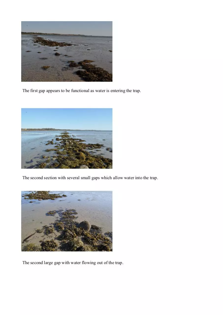
The first gap appears to be functional as water is entering the trap.
The second section with several small gaps which allow water into the trap.
The second large gap with water flowing out of the trap.
The third section
The third gap has been enlarged by the removal of some of the stones.
The fourth an fifth sections with several small breaks.
Looking NW back along the wall from the elbow.
Looking across the eastern arm from the elbow.
The water is still flowing over the eastern arm.
The alignment of the eastern wall and eye is continued across the eroded drumlin.
Supplemental Find Report
Several pieces of wood were exposed over the night of 27/28 April 2014, they form a line running
approx NE and are spread over 5 meters. The wood is in very poor condition with one piece partially crumbling whilst being brushed.
This piece starts the line from the wall of the fish trap.
A close up of the first piece of possibly worked wood.
This is piece continues under the overlay.
Several fragments of a thin plank approx 15mm thick.
The shape of this piece appears natural as the grain follows the curve.
The upper piece is a piece of plank approx 15mm thick, the lower continues under the overlay.
A more substantial piece of plank 20mm thick.
This piece is fairly square in profile.
A cluster of fragments.
The final piece in the sequence.
Download 149011
149011.pdf (PDF, 2.87 MB)
Download PDF
Share this file on social networks
Link to this page
Permanent link
Use the permanent link to the download page to share your document on Facebook, Twitter, LinkedIn, or directly with a contact by e-Mail, Messenger, Whatsapp, Line..
Short link
Use the short link to share your document on Twitter or by text message (SMS)
HTML Code
Copy the following HTML code to share your document on a Website or Blog
QR Code to this page

This file has been shared publicly by a user of PDF Archive.
Document ID: 0000267476.