Kinmylies (PDF)
File information
Title: Northern Night Cup Round 2
Author: felte
This PDF 1.7 document has been generated by / Microsoft: Print To PDF, and has been sent on pdf-archive.com on 04/11/2015 at 12:13, from IP address 146.90.x.x.
The current document download page has been viewed 539 times.
File size: 384.12 KB (1 page).
Privacy: public file
File preview
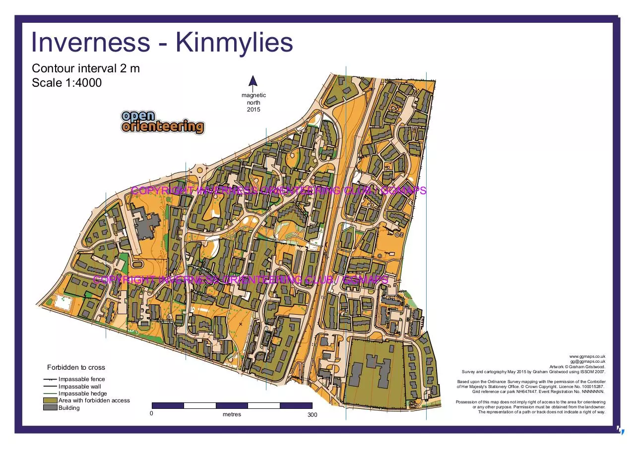
Inverness - Kinmylies
Contour interval 2 m
Scale 1:4000
magnetic
north
2015
COPYRIGHT INVERNESS ORIENTEERING CLUB / GGMAPS
COPYRIGHT INVERNESS ORIENTEERING CLUB / GGMAPS
www.ggmaps.co.uk
gg@ggmaps.co.uk
Artwork © Graham Gristwood.
Survey and cartography May 2015 by Graham Gristwood using ISSOM 2007.
Forbidden to cross
Impassable fence
Impassable wall
Impassable hedge
Area with forbidden access
Building
Based upon the Ordnance Survey mapping with the permission of the Controller
of Her Majesty's Stationery Office. © Crown Copyright. Licence No. 100015287.
Grid reference car park NH647447. Event Registration No. NNNNNNN.
0
metres
300
Possession of this map does not imply right of access to the area for orienteering
or any other purpose. Permission must be obtained from the landowner.
The representation of a path or track does not indicate a right of way.
Download Kinmylies
Kinmylies.pdf (PDF, 384.12 KB)
Download PDF
Share this file on social networks
Link to this page
Permanent link
Use the permanent link to the download page to share your document on Facebook, Twitter, LinkedIn, or directly with a contact by e-Mail, Messenger, Whatsapp, Line..
Short link
Use the short link to share your document on Twitter or by text message (SMS)
HTML Code
Copy the following HTML code to share your document on a Website or Blog
QR Code to this page

This file has been shared publicly by a user of PDF Archive.
Document ID: 0000312618.