168055 (PDF)
File information
Author: DAVID
This PDF 1.5 document has been generated by Microsoft® Office Publisher 2007, and has been sent on pdf-archive.com on 06/06/2015 at 14:59, from IP address 151.229.x.x.
The current document download page has been viewed 439 times.
File size: 1.36 MB (6 pages).
Privacy: public file


File preview
Photographic Survey
D.M.Irving
26/5/2015
Greyabbey Bay, South Island/Ballyurnenallen
MRD168:055 Stone Fish Trap
Description
A stone fish trap on the south-east side of South Island extends out from HWM across the
gradually sloping shore of small stones onto flat sand. It consists of two slightly curving leaders;
the western leader, which was altered by reconstruction during the 1970s, runs 53m east-south-east
to a gap 11m wide. The modern upper part is constructed of small to medium stones superimposed
on the base of the original trap. The base, which can be detected under the modern addition,
appears to be of tightly packed stones and is 1.7m wide. The stone bank continues east for 72 m,
where it begins to curve east north east for a further 22.6m. It then turns north-east, extending
64m, with an average width of 1.5m, culminating at the angle of the trap. The eastern leader is
now largely covered by shellfish which obscure a kerb-and-fill wall, running north-north-east for
127m. Where the wall is visible it is about 70cm wide. 92m north-north-east of the angle is a welldefined gap 4.0m wide, revealing a stone edge 4.0m wide on the north, and a south-facing edge
1.0m across. A length of wood, 2.0m long by 8cm thick, was noted 5.0m south-south-west of the
gap, but it is not known whether this is associated with the trap. The eastern wing merges into an
eroded drumlin on the north-north-east. A channel of water flows north - south through the
western leader, and a pool of water is retained behind it. At no time does this part of the fish trap
dry out completely.
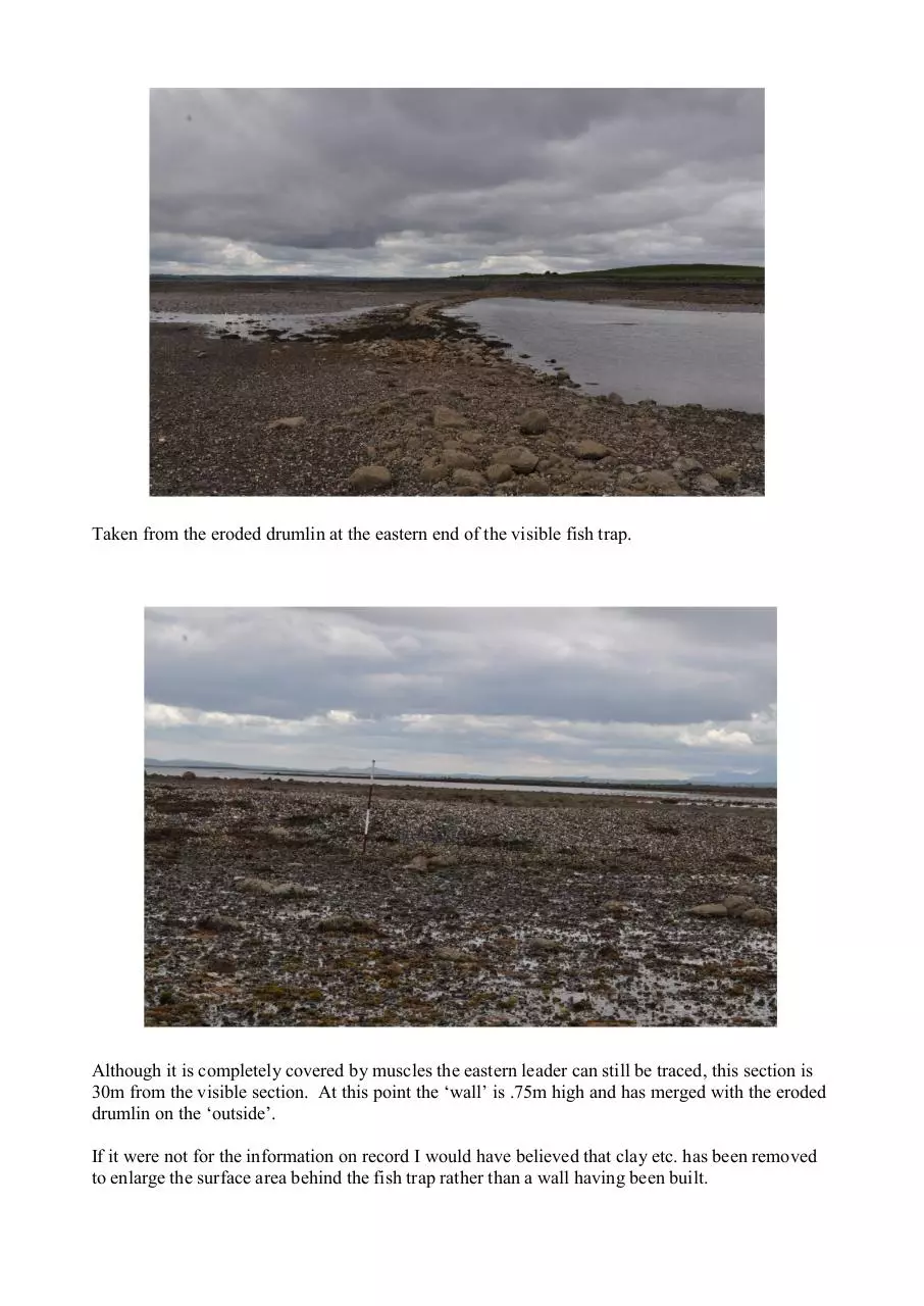
Taken from the eroded drumlin at the eastern end of the visible fish trap.
Although it is completely covered by muscles the eastern leader can still be traced, this section is
30m from the visible section. At this point the ‘wall’ is .75m high and has merged with the eroded
drumlin on the ‘outside’.
If it were not for the information on record I would have believed that clay etc. has been removed
to enlarge the surface area behind the fish trap rather than a wall having been built.
One of the exposed section of the kerb wall.
Taken from the south ‘outside’ the fish trap and showing the height of the wall near the centre.
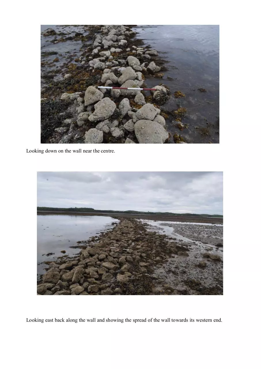
Looking down on the wall near the centre.
Looking east back along the wall and showing the spread of the wall towards its western end.
Looking east back along the wall and showing the reconstructed wall at its western end.
Looking across the gap at the western end of the wall, the outer (lefthand) edge shows the original
kerb very well.
Taken from the ridge on South Island during an incoming tide which highlights the extension of
the fish trap into the eroded drumlin.
Download 168055
168055.pdf (PDF, 1.36 MB)
Download PDF
Share this file on social networks
Link to this page
Permanent link
Use the permanent link to the download page to share your document on Facebook, Twitter, LinkedIn, or directly with a contact by e-Mail, Messenger, Whatsapp, Line..
Short link
Use the short link to share your document on Twitter or by text message (SMS)
HTML Code
Copy the following HTML code to share your document on a Website or Blog
QR Code to this page

This file has been shared publicly by a user of PDF Archive.
Document ID: 0000267478.